
Elevation 756 m Local time Monday 8:09 PM | Area 14.35 km² | |
 | ||
Weather 4°C, Wind SW at 10 km/h, 68% Humidity | ||
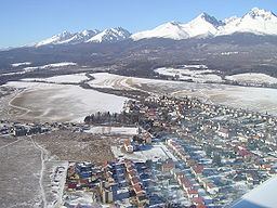
Batizovce is a village and municipality in Poprad District in the Prešov Region of northern Slovakia. Village dominants are evangelical and Roman Catholic churches in classic and baroque styles.
Contents
Map of Batizovce, Slovakia
Geography
The municipality lies at an altitude of 756 metres and covers an area of 14.348 km². It has a population of about 2125 people.
History
In historical records the village was first mentioned in 1264. Locals had been engaged in agriculture, forestry, pottery, weaving and charcoal production. In 1934 they began to be employed in Svit industrial facilities.
References
Batizovce Wikipedia(Text) CC BY-SA