
Gmina Barciany Local time Thursday 11:14 AM | Population 1,100 Elevation 68 m | |
 | ||
Weather 5°C, Wind S at 16 km/h, 84% Humidity Voivodeship Warmian-Masurian Voivodeship | ||
Barciany [barˈt͡ɕanɨ] (German: Barten) is a village in Kętrzyn County, Warmian-Masurian Voivodeship, in northern Poland, close to the border with the Kaliningrad Oblast of Russia. It is the seat of the gmina (administrative district) called Gmina Barciany. It lies approximately 15 kilometres (9 mi) north of Kętrzyn and 74 km (46 mi) north-east of the regional capital Olsztyn.
Map of Barciany, Poland
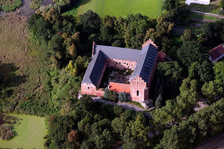
Its name originates from the name of the one Old Prussian tribe - Bartians. An Ordensburg was erected in 1325, but stone was not used until 1377.
Before 1945 the area was part of Germany (East Prussia). After World War II the region was placed under Polish administration by the Potsdam Agreement under territorial changes demanded by the Soviet Union. Most Germans fled or were expelled and replaced with Poles expelled from the Polish areas annexed by the Soviet Union or Ukrainians forced to settle in the area through Operation Vistula in 1947.
The village has a population of 1,100.