
Area 8.6 km² | Region Normandy Intercommunality Cingal Local time Thursday 9:39 AM | |
 | ||
Weather 6°C, Wind SW at 19 km/h, 85% Humidity | ||
Barbery is a French commune in the Calvados department in the Normandy region of north-western France.
Contents
- Map of 14220 Barbery France
- Geography
- Mapping
- History
- Administration
- Demography
- Civil heritage
- Religious heritage
- References
Map of 14220 Barbery, France
The inhabitants of the commune are known as Barberigeois or Barberigeoises.
Geography
Barbery is located some 18 km south by south-east of Caen and 10 km east by north-east of Thury-Harcourt. Access to the commune is by the D131 road from Croisilles in the south-west which passes through the heart of the commune and the village before continuing north-east to Urville. The D23 comes from Cesny-Bois-Halbout in the south and passes through the village before continuing north to join Route nationale N158 at Saint-Aignan-de-Cramesnil. The D156A goes south-east from the village to Moulines. The D237 branches off the D131 in the east of the commune and goes south-east to join the D167 east of the commune. Apart from the village there are the hamlets of L'Abbaye, Faverolles, Le Londel, and Le Mesnil Touffray. The commune is entirely farmland.
The Ruisseau du Val Clair rises north of the village and flows north to join the Laize at Bretteville-sur-Laize. The Ruisseau de Corneville also rises north of the village, east of the Ruisseau du Val Clair, and flows north to join the Laize at Les Écluses.
Mapping
A list of online mapping systems can be displayed by clicking on the coordinates (latitude and longitude) in the top right hand corner of this article. None of these maps, however, show the extent of nor any information on the commune.
History
During early medieval times Barbery and its abbey were under the control of the de Livet family.
Barbery appears as Barbery on the 1750 Cassini Map and the same on the 1790 version.
Administration
List of Successive Mayors
(Not all data is known)
Demography
In 2010 the commune had 729 inhabitants. The evolution of the number of inhabitants is known from the population censuses conducted in the commune since 1793. From the 21st century, a census of communes with fewer than 10,000 inhabitants is held every five years, unlike larger communes that have a sample survey every year.
Sources : Ldh/EHESS/Cassini until 1962, INSEE database from 1968 (population without double counting and municipal population from 2006)
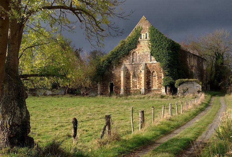
Civil heritage
The commune has many buildings and sites that are registered as historical monuments:
Religious heritage
The commune has several religious buildings and structures that are registered as historical monuments: