
Founded 1500 Time zone PST (UTC+8) Local time Thursday 2:37 PM Dialling code 2 | District 2nd District of Rizal Barangays Area 84.93 km² Province Rizal | |
 | ||
Weather 29°C, Wind E at 10 km/h, 63% Humidity Points of interest Wells Resort and Restaurant, Well’s Resort | ||
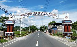
Baras is a fourth class municipality in the province of Rizal, Philippines. According to the 2015 census, it has a population of 69,300 people.
Contents
- Map of Baras Rizal Philippines
- History
- World War II and after
- Barangays
- Demographics
- St Joseph Parish
- Palo Alto Falls
- Kinamatayan Falls
- Masungi Georeserve
- Other places
- Sikaran
- References
Map of Baras, Rizal, Philippines
History
In 1595, the Franciscan missionaries under the leadership of Fr. Juan de Placencia and Fr. Diego de Oropesa, founded a “visita” for Morong on the present site of Bosoboso, south of Painaan with Apostol Santiago as its patron saint. It was known as “Visita de Santiago” or Santiago until such time that it became Baras. Baras was then inhabited by 400 Aetas and other mountain people.
In 1636, the town was transferred to a place called Ibayo, one and one-half leagues southeast of the first site due to the hostility of the Aetas and the mountaineers who burned part of the town and church in 1635. San Salvador became their patron saint. However, the town and church of Baras was burned by Chinese rebels in 1639, who were retreating from Manila to the Sierra Madre mountains.
The ecclesiastical administration of Baras was given back by the Jesuits to the Franciscan in 1679. Two years later In 1682, the town was transferred to its present site where they would not be menaced by marauding tribes of the mountaineers.
Baras was under the jurisdiction of the Province of Laguna from 1606 to 1853. Its administration was transferred to the newly created Distrito de las Monte de San Mateo in 1857. This district was changed to Distrito de Morong whose capital was in Antipolo but was later transferred to Morong.
In July 1895, the representatives of Katipunan came to inform the people of Morong, Tanay, Antipolo, Baras and Pililla about the cause of the secret society. The Katipuan of Baras established the Real or Military Camp at sitio of Gogo or Pamitinan. On November 21, 1896, the Katipunan attempted to capture the town of Morong but were driven by the Guardia Civil. By 1898, Baras had joined the Revolutionary Government of Emilio Aguinaldo.
After the defeat of the Spaniards in Morong, the Aguinaldo Headquarters ordered the establishment of the municipal township. A special election was held. However, the Revolutionary Government of Aguinaldo did not last because of the outbreak of the Filipino-American War. On March 29, 1900, Military Order No. 40, by Governor General Meritt came in effect. This order was for the election of an Alcalde Municipal, Vice Alcalde, and the Municipal Council. This was implemented in October of the same year.
Act 942 was passed by the Philippine Commission in 1902, providing the establishment of the Province of Rizal to be comprised in part of towns from the former Distrito de Morong. Baras effectively became part of the new province. However, in 1903, it was relegated to be a barrio under the town of Morong.
On January 16, 1906, Baras was annexed to Tanay as a barrio by Act No. 1442. But as Baras was not represented as a barrio of Tanay, and previously under Morong, there was a movement for the separation of Baras as an independent town. Under the leadership of Leopoldo Digma, the clamor was realized through Executive Order No. 57, dated November 24, 1920 establishing the Municipality of Baras.
World War II and after
During the Second World War, the Imperial Japanese armed forces occupied and entered the municipal town of Baras in 1942. The local guerrillas of the General Marking Unit sieged and invaded the town of Baras and attacked the Japanese from 1942 to 1945. The local Filipino troops of the Philippine Commonwealth Army and the Philippine Constabulary units liberated the municipality of Baras in 1945. The guerrillas of the General Marking Units defeated the Japanese forces and it ended World War II.
The Military General Headquarters and Camp Bases of the 53rd Infantry Division of the Philippine Commonwealth Army was established and active from January 3, 1942 to June 30, 1946 and built Camp Caparas in Baras. The military engagements of the Anti-Japanese Operations in Manila and Southern Luzon aided the local guerrilla resistance fighters and U.S. military forces against the Japanese Imperial forces.
The town of Baras was razed to the ground on March 10, 1945. This signified the liberation of the town but also left many homeless. The rehabilitation of the town began. War damage claims were filed to the amount of P 300,000 to be used for the construction of new houses. Then mayor, Mariano Golla, focused on the improvement of roads and the construction of a public dispensary. Under his term, Baras was elevated to a fourth class municipality due to an increase in income.
Under the succeeding administrations, improvements of road networks were implemented; seven liberty wells were constructed; the number of school houses were increased; river controls in Barangay San Juan and San Jose were constructed; rehabilitation of the existing government building continued; and a reforestation program was launched.
Barangays
Baras is politically subdivided into 10 barangays (1 urban, 9 rural):
Demographics
In the 2015 census, the population of Baras, Rizal, was 69,300 people, with a density of 820 inhabitants per square kilometre or 2,100 inhabitants per square mile.
St. Joseph Parish
The oldest and most notable landmark in Baras is the St. Joseph Church, built by the Franciscan missionaries in 1682, the same year the town was transferred to its present site. It was completed in 1686 and was dedicated to St. Joseph, the town's patron saint. It is known for having paniki in its ceiling. The Church has been seen in well-known international and local films, TV series and commercials.
Palo Alto Falls
This breathtaking man-made falls in Palo Alto is just an hour drive from the Town's poblacion.
Kinamatayan Falls
Legend says two lovers who had a family issues committed suicide to the falls so no one will be able to separate them. The Falls is now being managed by the Local Government Unit. Few minutes of hike will take you to the cold as ice falls of Kinamatayan.
Masungi Georeserve
A conservation area adjacent to Garden Cottages located in the mountainous section of Baras by its border with Tanay, Rizal.
Other places
Sikaran
Baras is also the home the one of the Philippines' native martial arts', Sikaran, Its Grandmaster, retired Philippine Air Force Col. Meliton Geronimo, who descended from the ranks of “hari,” a term for accomplished sikaran master. In addition, he has also served as town mayor.