
PIN 325202 Area 6,992 km² Area code 07453 | Time zone IST (UTC+5:30) Telephone code 07453 Elevation 262 m | |
 | ||
Baran district is a district in the Indian state of Rajasthan. The headquarters of the district are located at the city of Baran.
Contents
Map of Baran, Rajasthan
History
Before Indian independence in 1947, most of present-day Baran District was part of the princely state of Kota. It was formed on 10 April 1991 by carving out Kota district.
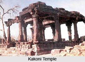
The 10th century Bhand Deva Temple in the style of Khajuraho Group of Monuments is situated on the banks of a pond in the centre of the 4 km wide Ramgarh crater about 40 km from the city of Baran, Rajasthan.
Geography
Baran is located at 25.1°N 76.52°E / 25.1; 76.52. It has an average elevation of 262 metres (859 feet).
Rivers
Kali Sindh, Parvati River, Parwan River, Andheri, Ban-Ganga are the major rivers.
Climate
The City has a dry climate except in the monsoon seasons. The winter season runs from mid of November to February and summer season runs from March to mid of June. The period from mid of June to September is the monsoon season followed by the months October to mid of November constitute the post monsoon or the retreating monsoon. The average rainfall in the district is 895.2mm. January is the coldest month with the average daily maximum temperature of 24.3'C and the average daily minimum temperature of 10.6'C.
Demographics
According to the 2011 census the Baran district had a population of 1,222,755. It roughly equals to the nation of Trinidad and Tobago or the US state of New Hampshire. This gives it a ranking of 389th in India (out of a total of 640). The district has a population density of 175 inhabitants per square kilometre (450/sq mi). Its population growth rate over the decade 2001-2011 was 19.8%. Baran has a sex ratio of 926 females for every 1000 males, and a literacy rate of 67.38%.
Roadways
The city is connected with neighbouring districts and with major cities outside the state. National Highway No.76 (now National Highway No. 27) passes through the district. National Highway No.76 (now National Highway No. 27) is a part of East-West Corridor.
Airways
The nearest major airports are located at Jaipur International Airport, Udaipur Airport, and Jodhpur Airport. These airports connect Rajasthan with the major cities of India such as Delhi and Mumbai. There are two other airports in Kota and Jaisalmer, but are not open for commercial/civilian flights yet.
Railway
Baran station is situated on Kota-Bina section of Western Central Railways. It is about 67 km from Kota Junction.
Cuisine
Typical dishes include Dal Baati Churma, Roti(chapati)