
Settlements 13 Postal code 11460 Area 213 km² | Time zone CET (UTC+1) Area code +381(0)11 Local time Thursday 6:55 AM | |
 | ||
Weather 2°C, Wind S at 6 km/h, 76% Humidity | ||
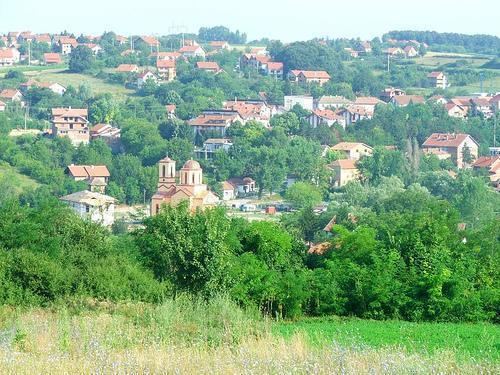
Mtb street view 76 barajevo serbia belgrade to mt kosmaj 4 4 duboki potok 07 2013
Barajevo (Serbian Cyrillic: Барајево, [bǎrajɛv̞ɔ]) is a suburban neighborhood and one of 17 municipalities which constitute the city of Belgrade, the capital of Serbia. According to the 2011 census results, the municipality has a population of 27,110 inhabitants.
Contents
- Mtb street view 76 barajevo serbia belgrade to mt kosmaj 4 4 duboki potok 07 2013
- Map of Barajevo Serbia
- Municipality
- Settlements
- Demographics
- History and politics
- Economy
- Culture and tradition
- References
Map of Barajevo, Serbia
Municipality
The urban settlement of Barajevo is still statistically classified as a rural (village). It is growing by even higher rate than the municipality as a whole (census 2002, 8,325 inhabitants). It is located east of the 'Parcanski vis' hill, northern part of the Kosmaj mountain, in the valley of the Beljanica river (or Barajevska reka; Cyrillic: Бељаница or Барајевска река), a tributary to the Turija river.
Many outer settlements and hamlets are built as Barajevo grows and stretches in all directions making one continuous built-up are with the neighboring settlements (Guncati, Baćevac, Lisović, Boždarevac, Guberevac in Sopot municipality): Bela Reka, Dražanovac, Dubrave, Gaj (a separate local community with a population of 1,930 in 2002), Glumčevo Brdo (a separate local community, split after the 2002 census), Karaula, Nenadovac, Pajšuma, Ravni Gaj, Srednji Kraj, Stara Lipovica, Suva Šuma, Trebež (the industrial zone), Vitkovica.
Municipality is located in the low part of Šumadija, southeast of the Belgrade, with an elevation spanning from 140 to 364 m. Most of the municipal territory belongs to the drainage area of the Turija river, right tributary of the Peštan river, which in turn flows into the Kolubara, thus whole area geographically gravitates to the Kolubara region.
Settlements
The municipality of Barajevo covers an area of 213 km² and includes 13 settlements, all of which are statistically classified as rural, not urban:
It also includes various sub-settlements and hamlets spawning around the central settlements:
Demographics
The municipality has a population of 27,110 inhabitants, according to the 2011 census results. Two major traffic routes, the Ibar Highway and the railway Belgrade-Bar (Montenegro), are passing through the municipal territory.
Ethnic structure (census 2002): Serbs 94,5%, Romani 0,8%, Montenegrins 0,7%.
History and politics
Municipality was created in 1956 and immediately became administratively part of the wider Belgrade area. In 1957 a nearby municipality of Beljina was annexed to Barajevo, and in 1960 Umka municipality has been divided between Čukarica and Barajevo (villages of Meljak and Vranić).
Recent presidents of the municipal assembly:
Economy
The economy is not much developed. Being an agricultural area, Barajevo has a mill, large orchard farm, a veterinarian station and the hunting & forestry company of Lipovička šuma. Wheat, barley, oats and corn are being grown. Industry is based on the small construction and electronic companies and the ball bearing factory.
Barajevo is outside major roads, but it is located on the Belgrade-Bar railway. The settlement itself was further away, but as it grew, it reached the railway.
Culture and tradition
Cultural festival, the Barlet, (Barajevo summer) is held annually. Artificial lake 'Duboki potok' (Cyrillic: Дубоки поток; Deep brook) is located near the Barajevo, with the large weekend-settlement.
First mention of the name Barajevo is from the 16th century. The popular story that the settlement got its name from the multitude of springs in this area [Serbian: bara je ovo (this is a pond)] is probably not true.
Also, the reality TV show The Farm is captured in the village of Lisović.