
Intercommunality Pays rethélois Area 19.01 km² Population 139 (1999) | Canton Château-Porcien Time zone CET (UTC+1) Local time Thursday 3:12 AM | |
 | ||
Weather 7°C, Wind W at 26 km/h, 77% Humidity | ||
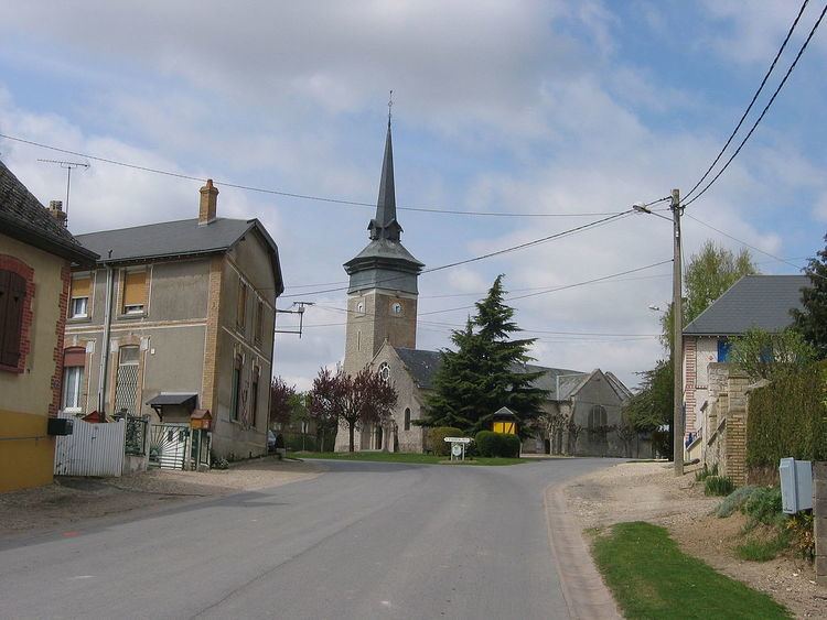
Banogne-Recouvrance is a French commune in the Ardennes department in the Grand Est region of northern France.
Contents
- Map of Banogne Recouvrance France
- Geography
- History
- Administration
- Demography
- Sites and monuments
- Notable people linked to the commune
- References
Map of Banogne-Recouvrance, France
The inhabitants of the commune are known as Banognais or Banognaises.
Geography
Banogne-Recouvrance is located some 20 km north-west of Rethel and 33 km east of Laon. Access to the commune is by the D30 road from Saint-Quentin-le-Petit in the north-west which passes through the centre of the commune and the village and continues south-east to Condé-lès-Herpy. The D35 goes from the village to Le Thour in the south-west. The D135 goes north from the village to join the D2 north of the commune. Apart from the village at the centre of the commune there is the hamlet of Recouvrance to the east. The commune is entirely farmland.
The writer Ernst Jünger remembered his passing through the village as a small village off the main roads, nestled in graceful chalk hills.
History
The village is mentioned in cartularies of the 13th century.
In 1570 Banogne is described in the census as attached to the Parish of Thour whose barons and the Hotel Dieu de Reims share the land. A strong ditch surrounded Recouvrance providing a refuge for the inhabitants. A place called Ruisselois was the property of the Abbey of Signy then of the Jesuit college in Reims. A white chalk quarry is operated nearby.
In 1822 these villages were united into one commune with Banogne at the centre (with Le Ruisselois as a hamlet). Recouvrance also became a hamlet.
In 1918 the village was the site of fierce fighting during the Battle of St. Quentin Canal in the last weeks of the war. On 25 October the French army captured the heights of the commune and so seized the last stretch between Saint-Quentin and the Aisne valley of the system of German fortifications from La Fère to Rethel called the Hunding Stellung. Of the 125 houses in the town only 10 remained standing at the end of the fighting. The village and the church were rebuilt in the following decade.
Administration
List of Successive Mayors
(Not all data is known)
Demography
In 2010 the commune had 160 inhabitants. The evolution of the number of inhabitants is known from the population censuses conducted in the commune since 1793. From the 21st century, a census of communes with fewer than 10,000 inhabitants is held every five years, unlike larger communes that have a sample survey every year.
Sources : Ldh/EHESS/Cassini until 1962, INSEE database from 1968 (population without double counting and municipal population from 2006)