
 | ||
Banks Peninsula is a peninsula of volcanic origin on the east coast of the South Island of New Zealand. It has an area of approximately 1,150 square kilometres (440 sq mi) and encompasses two large harbours and many smaller bays and coves. The South Island's largest city, Christchurch, is immediately north of the peninsula.
Contents
- Map of Banks Peninsula Robinsons Bay 7581 New Zealand
- History
- Geology
- Land use
- Tourism
- Statistics
- References
Map of Banks Peninsula, Robinsons Bay 7581, New Zealand
History
Three successive phases of Māori settlement took place on the peninsula, which is still known to Māori as Te Pataka o Rakaihautu (The Storehouse of Rakaihautu). Rakaihautu brought the Waitaha to the South Island in the waka (canoe) Uruao; they were the first people to light the fires of occupation. Thus Banks Peninsula was named Te Pataka o Rakaihautu in recognition of his deeds and the abundance of mahinga kai (foods of the forests, sea, rivers and skies) found on the peninsula. Waitaha settled there first, followed by Kāti Mamoe, and then Ngai Tahu took over in the 17th century.
The crew of Captain James Cook became the first Europeans to sight the peninsula on 17 February 1770, during Cook's first circumnavigation of New Zealand. Cook described the land as "of a circular figure ... of a very broken uneven surface and [having] more the appearance of barrenness than fertility." Deceived by the outline of higher land behind the peninsula, Cook mistook it for an island and named it "Banks Island" in honour of Endeavour's botanist, Joseph Banks. Distracted by a phantom sighting of land to the southeast, Cook then ordered Endeavour away to the south without exploring more closely.
By the 1830s, Banks Peninsula had become a European whaling centre – to the detriment of the Māori, who succumbed in large numbers to disease and intertribal warfare exacerbated by the use of muskets. Two significant events in the assumption of British sovereignty over New Zealand occurred at Akaroa. First, in 1830 the Māori settlement at Takapuneke became the scene of a notorious incident. The Captain of the British brig Elizabeth, John Stewart, helped North Island Ngāti Toa chief, Te Rauparaha, to capture the local Ngai Tahu chief, Te Maiharanui. The settlement of Takapuneke was sacked. (Partly as a result of this massacre, the British authorities sent an official British Resident, James Busby, to New Zealand in 1832 in an effort to stop such atrocities. The events at Takapuneke thus led directly to the signing of the Treaty of Waitangi.) Then in 1838 Captain Langlois, a French whaler, decided that Akaroa would make a good settlement to service whaling ships and "purchased" the peninsula in a dubious land deal with the local Māori. He returned to France, floated the Nanto-Bordelaise company, and set sail for New Zealand with a group of French and German families aboard the ship Comte de Paris, with the intention of forming a French colony on a French South Island of New Zealand.
However, by the time Langlois and his colonists arrived at Banks Peninsula in August 1840, many Māori had already signed the Treaty of Waitangi (the signatories including two chiefs at Akaroa in May) and New Zealand's first British Governor, William Hobson, had declared British sovereignty over the whole of New Zealand. On hearing of the French plan for colonisation, Hobson quickly dispatched the HMS Britomart from the Bay of Islands to Akaroa with police magistrates on board. While Langlois and his colonists sheltered from unfavourable winds at Pigeon Bay on the other side of the peninsula, the British raised their flag at Greens Point between Akaroa and Takapuneke and courts of law convened to assert British sovereignty over the South Island.
From the 1850s, Lyttelton and then Christchurch outgrew Akaroa, which has developed into a holiday resort and retained many French influences as well as many of its nineteenth-century buildings.
Historic harbour defence works dating from 1874 onwards survive at Ripapa Island in Lyttelton Harbour, and at Godley Head.
In 2011, the Christchurch earthquakes of Feb and June had their epicentres in the Port Hills, significantly affecting communities.
Geology
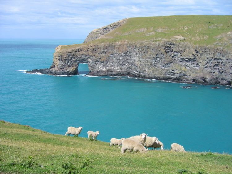
Banks Peninsula forms the most prominent volcanic feature of the South Island. Geologically, the peninsula comprises the eroded remnants of two large composite shield volcanoes (Lyttelton formed first, then Akaroa), and the smaller Mt Herbert Volcanic Group. These formed due to intraplate volcanism between approximately eleven and eight million years ago (Miocene) on a continental crust. The peninsula formed as offshore islands, with the volcanoes reaching to about 1,500 m above sea level. Two dominant craters formed Lyttelton and Akaroa Harbours. The Canterbury Plains formed from the erosion of the Southern Alps (an extensive and high mountain range caused by the meeting of the Indo-Australian and Pacific tectonic plates) and from the alluvial fans created by large braided rivers. These plains reach their widest point where they meet the hilly sub-region of Banks Peninsula. A layer of loess, a rather unstable fine silt deposited by the foehn winds which bluster across the plains, covers the northern and western flanks of the peninsula. The portion of crater rim lying between Lyttelton Harbour and Christchurch city forms the Port Hills.
Land use
Estimates suggest that native forest once covered 98% of the peninsula. However, Māori and European settlers successively denuded the forest cover and less than 2% remains today, although some reforestation has started. European settlers have planted many English trees, notably walnut.
Hinewai Reserve, a private nature reserve, has been established on the peninsula to allow for native forest to regenerate on land that was once farmed.
Several sites off the coast of the peninsula serve for mariculture cultivation of mussels.
A large Marine Mammal Sanctuary, mainly restricting set-net fishing, surrounds much of the peninsula. This has the principal aim of the conservation of Hector's dolphin, the smallest of all dolphin species. Eco-tourism based around the playful dolphins has now become a significant industry in Akaroa.
The relatively small Pōhatu Marine Reserve centres on Flea Bay on the south-east side of the peninsula and the larger Akaroa Marine Reserve lies at the entrance to the Akaroa Harbour.
The Summit Road forms a notable feature on the peninsula. Built in the 1930s, the road is in two sections:
Tourism
An attraction for trampers and bushwalkers is the Banks Peninsula Track.
Following the major earthquakes of 2011 and 2012, which affected Christchurch and Lyttelton (the harbour serving Christchurch), cruise ships were diverted to Akaroa Harbour.