
Country Indonesia Time zone WITA (UTC+8) Website www.banglikab.go.id Province Bali | Capital Bangli Area code(s) +62 366 Area 520.8 km² Population 213,808 (2010) | |
 | ||
Points of interest Mount Batur, Pura Ulun Danu Batur, Mount Merapi Museum, Jalan Penglipuran, Pura Kehen | ||
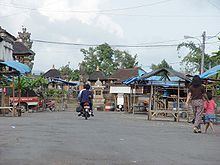
Bangli is a regency (kabupaten) of Bali, Indonesia. It has an area of 520.81 km2 and population of 197,210 (2004). Its regency seat is Bangli.
Contents
Map of Bangli Regency, Bali, Indonesia
Up till 1907, Bangli was one of the nine kingdoms of Bali. The capital has a famous Hindu temple, the Pura Kehen, which dates from the 11th century. Bangli also has one village, lies surround a hill, Demulih.
The northern part of the district included the main road to the north coast passing through Kintamani and around the crater in which Gunung Batur sits.
From the Demulih hill, Bali Island, particularly its southern part can be seen – Kuta, Nusa Dua, Gianyar and a part of Klungkung.
Administration
The regency is divided into four districts (kecamatan):
References
Bangli Regency Wikipedia(Text) CC BY-SA