
Seat Wat Tha Phra Time zone ICT (UTC+7) Geocode 1016 Population 71,087 (2013) | Khwaeng 2 Postal code 10600 Area 6.18 km² Province Bangkok | |
 | ||
Similar Bangkok Noi District, Khlong San District, Wat Arun, Thonburi, Wongwian Yai | ||
Bangkok Yai (Thai: บางกอกใหญ่; [bāːŋkɔ̀ːk jàj]) is one of the 50 districts (khet) of Bangkok, Thailand. Neighbouring districts are (from north clockwise) Bangkok Noi, Phra Nakhon (across Chao Phraya River), Thon Buri, Phasi Charoen, and Taling Chan.
Contents
Map of Bangkok Yai, Bangkok 10600, Thailand
History
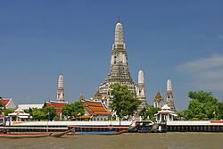
The district is named after Khlong Bangkok Yai (คลองบางกอกใหญ่, also called Khlong Bang Luang, คลองบางหลวง) which was actually part of Chao Phraya River until a canal dug in 1522 during the Ayutthaya period altered the flow of the river such that the canal became the main river and the section of original river became present-day Khlong Bangkok Yai. Bangkok Yai, or more precisely, the Wat Arun Sub-district, was also the site of Thon Buri when the capital was set up here from 1767-1782.
Originally called Amphoe Hongsaram (หงสาราม) when the district was set up in 1915, it was renamed "Amphoe Bangkok Yai" in 1916, demoted to a king amphoe of amphoe Bang Yi Khan (บางยี่ขัน) in 1938, promoted back to amphoe in 1958, and finally changed to a khet in an administrative reform in 1972.
Places
Administration
The district is sub-divided into two sub-districts (khwaeng).