
Country Thailand Khwaeng 4 Time zone THA (UTC+7) Area 11.36 km² Province Bangkok | Seat Bang O Khet established 1989 Postal code 10700 Population 98,113 (2013) | |
 | ||
Bang Phlat (Thai: บางพลัด; [bāːŋ pʰlát]) is one of the 50 districts (Khet) of Bangkok, Thailand. Its neighbor districts, clockwise from the north, are Amphoe Bang Kruai, Bang Sue, Dusit, Phra Nakhon, Bangkok Noi, and Taling Chan.
Contents
Map of Bang Phlat, Bangkok 10700, Thailand
History
Bang Phlat was one of the 25 districts created in 1915, when the inner districts of Bangkok were reorganized. In 1938 the district was abolished and added into Bangkok Noi.
Bang Phlat district was again set up in 1989 taking 4 sub-districts from Bangkok Noi. West side of Borommaratchachonnani Road and Somdet Phra Pin Klao Road were moved back to Bangkok Noi in 1991, creating the new Arun Amarin sub-district.
Bang Phlat has a number of transliteration spellings that are visible across the district including: Bang Phlat, Bang Phlad, Bang Plat, Bang Plad
It is likely that this spelling will become unified as the new MRT station stop has been titled "Bang Phlat".
Places
The main road running through Bang Phlat is Charan Sanit Wong, a road that parallels the Chao Phraya to the West from Thon Buri up to the Rama VII bridge.
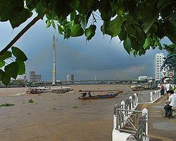
Bang Phlat has a mixture of light commercial, industrial and residential zones. There are a few medium commercial and residential areas which are growing as the area becomes more prosperous. There are 2 Express River Boat stations servicing Bang Phlat, Saphan Krung Thon to the South and Saphan Rama 7 to the North.
Administration
The district is sub-divided into 4 sub-districts (Kwaeng).