
Country Thailand Time zone ICT (UTC+7) Geocode 8413 Population 21,797 (2005) | Seat Ban Na Postal code 84240 Area 207.3 km² Province Surat Thani Province | |
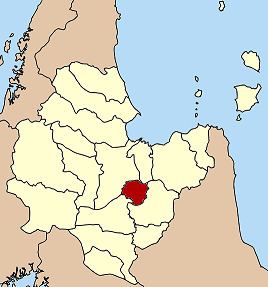 | ||
Ban Na Doem is a district (amphoe) of Surat Thani Province, Thailand.
Contents
Map of Ban Na Doem District, Surat Thani, Thailand
Geography
Ban Na Doem is in the center of Surat Thani province. Neighboring district are (from the north clockwise) Mueang Surat Thani, Ban Na San, Khian Sa, and Phunphin.
The Tapi River forms part of the western boundary of the district. A smaller river in the district is the Khlong Lamphun.
History
Lamphun District, one of the original districts of Surat Thani Province, was administrated from the town of Ban Na, which is now the center of the Ban Na Doem district. On 1 July 1938, however, the district office was moved to Na San and the district was renamed to Ban Na San one year later.
Effective 25 April 1976 the area around Ban Na was split off from Ban Na San district and formed a new minor district (king amphoe). The minor district was originally subdivided into the two tambon, Ban Na and Tha Ruea. 15 August 1982 the tambon Sap Thawi was split from Tha Ruea, on 1 July 1983 Na Tai from Ban Na.
On May 21, 1990 the minor district was elevated to full district status.
Administration
Ban Na Doem is subdivided into 4 subdistricts (tambon), which are further subdivided into 30 villages (muban). There is one township (thesaban tambon) Ban Na, covering parts of tambon Ban Na and Na Tai. Each tambon has a tambon administrative organization (TAO), responsible for the area not covered by the township.