
Primary outflows Sandia Creek Surface area 556 acres (225 ha) Area 225 ha | Basin countries United States Surface elevation 971 m | |
 | ||
Primary inflows | ||
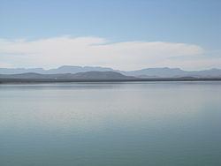
Balmorhea Lake is a reservoir on Sandia Creek 2 miles (3 km) southeast of downtown Balmorhea, Texas. Water from Toyah Creek, fed by the nearby San Solomon Springs, is also fed into the reservoir, as is excess water in the Phantom Lake Canal. The reservoir was built in 1917 by the construction of a dam by the Reeves County Water Improvement District. The reservoir provides water for irrigation, and is a popular recreational spot for locals.
Contents
Map of Balmorhea Lake, Texas 79718, USA
Balmorhea Lake is also known as Lower Parks Reservoir.
Fishing
Balmorhea Lake has been stocked with species of fish intended to improve the utility of the reservoir for recreational fishing. Fish that are present in Balmorhea Lake include largemouth bass, sunfish, European carp, mirror carp, grass carp, quillback, channel catfish, black bullhead, and gizzard shad.
Recreational uses
Balmorhea Lake is used for swimming, fishing, bird-watching, and boating.