
Canton Garlin Area 6.06 km² | ||
 | ||
Baliracq-Maumusson is a French commune of the Pyrénées-Atlantiques department in the Nouvelle-Aquitaine region of south-western France.
Contents
- Map of 64330 Baliracq Maumusson France
- Geography
- Toponymy
- History
- Administration
- Inter communality
- Demography
- Civil heritage
- Religious heritage
- References
Map of 64330 Baliracq-Maumusson, France
The inhabitants of the commune are known as Baliracois or Baliracoises.
Geography
Baliracq-Maumusson is located some 45 km east by north-east of Orthez and 20 km south of Aire-sur-l'Adour. Access to the commune is by the D211 road from Lannecaube in the south which passes through the length of the commune along the eastern side to join the D41 just north of the commune. Access to the village of Baliracq is by Le Moulin road branching from the D211. The commune is mixed forest and farmland.
The Lées river forms the eastern border of the commune as it flows north to join the Adour near Aire-sur-l'Adour. The Gabassot forms the northern border of the commune as it flows east into the Lées. Two other streams rise in the commune and flow into the Lées.
Toponymy
According to Michel Grosclaude the name Baliracq probably came from a Latin man's name Valerus with the Gallo-Roman suffix -acum giving the "Domain of Valerus". For Maumusson he proposed a Gascon man's name: the nickname mau meaning "bad" combined with mus meaning "nose" and the suffix -on giving "unfriendly" or "sullen".
The following table details the origins of the commune name and other names in the commune.
Sources:
Origins:
History
Paul Raymond noted on page 20 of his 1863 dictionary that Baliracq was a vassal of the Viscounts of Béarn.
The communes of Baliracq and Maumusson were merged in 1828.
Administration
List of Successive Mayors
(Not all data is known)
Inter-communality
The commune is part of six inter-communal structures:
Demography
In 2010 the commune had 145 inhabitants. The evolution of the number of inhabitants is known from the population censuses conducted in the commune since 1793. From the 21st century, a census of communes with fewer than 10,000 inhabitants is held every five years, unlike larger communes that have a sample survey every year.
Sources : Ldh/EHESS/Cassini until 1962, INSEE database from 1968 (population without double counting and municipal population from 2006)
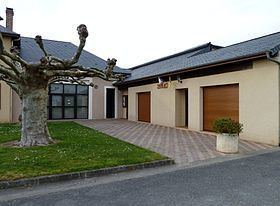
Civil heritage
The commune has a number of buildings and structures that are registered as historical monuments:
Religious heritage
The Parish Church of Saint Peter (11th century) is registered as an historical monument. The Church contains many items that are registered as historical objects: