
Area 13.06 km² Population 94 (1999) | Intercommunality Chavengeois Local time Wednesday 12:06 AM | |
 | ||
Weather 6°C, Wind SW at 29 km/h, 81% Humidity | ||
Balignicourt is a French commune in the Aube department in the Grand Est region of north-central France.
Contents
- Map of 10330 Balignicourt France
- Geography
- Administration
- Demography
- Religious heritage
- Notable people linked to the commune
- References
Map of 10330 Balignicourt, France
Geography
Balignicourt is located some 18 km north-west of Brienne-le-Château and 25 km south by south-west of Vitry-le-François. The northern border of the commune is the departmental boundary between Aube and Marne. Access to the commune is by the D56 from Jasseines in the west which passes through the south of the commune and the village before continuing east to Chavanges. The D156 goes north-east from the village to Margerie-Hancourt, changing to the D355 at the departmental border. Apart from the village there are the hamlets of Les Ormées, Vendeuil and Les Vieilles-Vignes. The commune is entirely farmland except for a belt of forest along the river.
The Meldançon river flows through the commune from east to west and continues west to join the Aube near Morembert.
Administration
List of Successive Mayors
(Not all data is known)
Demography
In 2010 the commune had 77 inhabitants. The evolution of the number of inhabitants is known from the population censuses conducted in the commune since 1793. From the 21st century, a census of communes with fewer than 10,000 inhabitants is held every five years, unlike larger communes that have a sample survey every year.
Sources : Ldh/EHESS/Cassini until 1962, INSEE database from 1968 (population without double counting and municipal population from 2006)
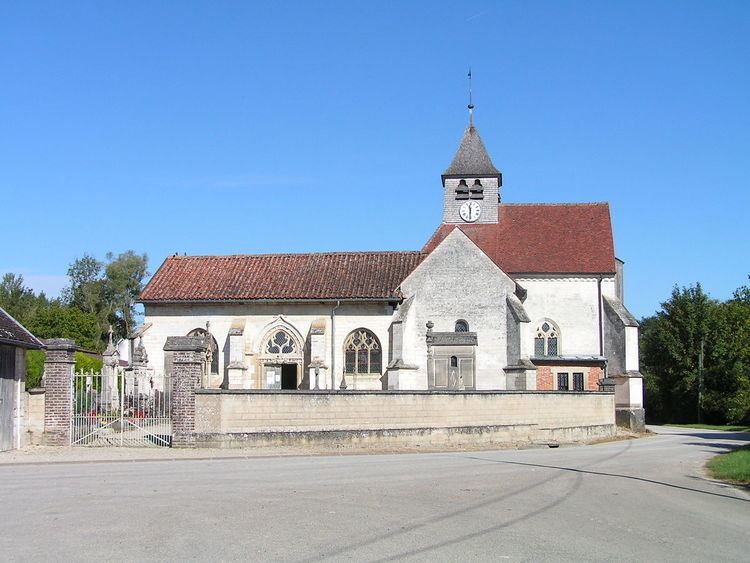
Religious heritage
The commune has two religious buildings that are registered as historical monuments: