
Department Bas-Rhin Population (2010) 625 Area 10.18 km² | Canton Saverne Time zone CET (UTC+1) Local time Tuesday 10:12 PM | |
 | ||
Weather 4°C, Wind SW at 24 km/h, 80% Humidity Points of interest Bechtoldt Pett Emmie Michele | ||
Balbronn (German: Ballbronn) is a French commune in the Bas-Rhin department in the Grand Est region of north-eastern France.
Contents
- Map of 67310 Balbronn France
- Geography
- History
- Administration
- Demography
- Civil heritage
- Religious heritage
- Notable people linked to the commune
- References
Map of 67310 Balbronn, France
The inhabitants of the commune are known as Balbronnais or Balbronnaises.
Geography
Balbronn is located some 25 kilometres west of Strasbourg and 8 km south-west of Wasselonne. Access to the commune is by the D75 road from Westhoffen in the north which passes through the village and continues west through the commune then south-west to Oberhaslach. The D275 goes from the village south-east to Bergbieten. The commune is mostly farmland but with large forests north of the D75 in the west of the commune.
Le Schleithal river flows south through the forests in the west and continues south through the commune to join the Bruche at Dinsheim-sur-Bruche. The Niedermattgraben rises near the village and flows south-east to join the Kehlbach east of Bergbieten.
History
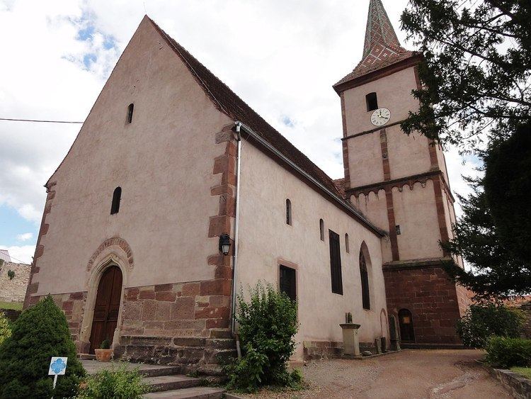
In his chronicle, Hertzog describes Balbronn as a Staettlin (small town). The church is very old. Inside it is a headstone from 1574 containing the remains of Jean de Mittelhausen and his wife Barbe Hufel.
In the forests in the west of Balbronn there was once a village called Elbersforst which was in a large clearing in the forest where there is now the Auberge d'Elemerforst. A plaque indicates that the place is the property of the Notre Dame works. Stones from the old village can still be seen above the restaurant patio. These are the old foundations of several buildings of what was formerly called Elbersforst. Since 2007 this medieval town has been the subject of archaeological excavations. Elbersforst was part of Westhoffen which depended on Marmourtier Abbey.
Administration
List of Successive Mayors
(Not all data is known)
Demography
In 2010 the commune had 625 inhabitants. The evolution of the number of inhabitants is known from the population censuses conducted in the commune since 1793. From the 21st century, a census of communes with fewer than 10,000 inhabitants is held every five years, unlike larger communes that have a sample survey every year.
Sources : Ldh/EHESS/Cassini until 1962, INSEE database from 1968 (population without double counting and municipal population from 2006)
Civil heritage
The commune has many buildings and sites that are registered as historical monuments:
Religious heritage
The commune has several religious buildings and structures that are registered as historical monuments: