
Country Philippines Time zone PST (UTC+8) Area 207 km² Province Eastern Samar | Barangays ZIP code 6801 Local time Wednesday 4:34 AM | |
 | ||
Region Eastern Visayas (Region VIII) Congr. district Lone district of E. Samar Weather 24°C, Wind NE at 5 km/h, 92% Humidity | ||
Balangkayan is a fifth class municipality in the province of Eastern Samar, Philippines. According to the 2015 census, it has a population of 10,125 people.
Contents
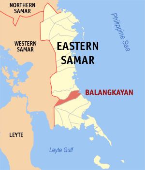
Map of Balangkayan, Eastern Samar, Philippines
Barangays
Balangkayan is politically subdivided into 15 barangays.
Demographics
In the 2015 census, the population of Balangkayan, Eastern Samar, was 10,125 people, with a density of 49 inhabitants per square kilometre or 130 inhabitants per square mile.
Tourism
The Minasangay Island Marine Ecological Park and Resort known for its cliff diving, scuba diving, mangroves and coral reefs is a popular gateway for the locals of the province.
Education
Balangkayan has many elementary schools and a lone high school.
Elementary schools:
Secondary school:
References
Balangkayan, Eastern Samar Wikipedia(Text) CC BY-SA