
Population 5,383 (2011) Postal code 3183 | Postcode(s) 3183 Area 80 ha | |
 | ||
Federal division Division of Melbourne Ports | ||
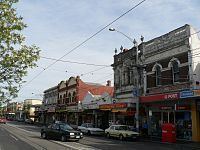
Balaclava is an inner suburb of Melbourne, Victoria, Australia, 7 km south from Melbourne's Central Business District. Its local government area is the City of Port Phillip. At the 2011 Census, Balaclava had a population of 5,383.
Contents
- Map of Balaclava VIC 3183 Australia
- Streets
- Local landmarks
- Places of worship
- Transport
- Notable residents
- References
Map of Balaclava VIC 3183, Australia
Balaclava is located in the south-east of the city, in the St Kilda East area and is bounded by Inkerman Street to the north, Chapel Street to the west, Hotham Street to the east and Oak Grove and Los Angeles Court to the south. In terms of its cadastral division, Balaclava is in the parish of Prahran, within the County of Bourke
The suburb was named after the Battle of Balaclava that took place on 25 October 1854, during the Crimean War.
Well known television celebrity Graham Kennedy spent part of his childhood in the Balaclava area. After his death, the local council placed a commemorative plaque on the house in which he lived.
Balaclava is home to much of Melbourne's Orthodox Jewish Community, consisting of both Hasidim and non-Hasidim (Mitnagdim or Yeshivish) Jews. Within its confines are a number of kosher restaurants and shops that cater to the local and broader Melbourne Haredi communities.
Streets
Many streets in Balaclava and its vicinity are named after Crimean War battles; e.g., the Battle of Balaclava (Balaclava Road), the Battle of Inkerman (Inkerman Road), the Siege of Sevastopol (Sebastopol Street), the Battle of the Alma River (Alma Road), the Battle of the Great Redan (Redan Street) and the Battle of Malakoff (Malakoff Street).
One street, Crimea Street, is named after the war itself.
Other streets in the district are named after people connected with the Crimean War; e.g., Lord Raglan (Raglan Street), Lord Cardigan (Cardigan Street), Florence Nightingale (Nightingale Street), François Certain Canrobert (Canrobert Street) and Lord Lucan (Lucan Street).
Local landmarks
Places of worship
There are many churches in Balaclava, with many of the modern places of worship serving the Jewish Faith, but many of the older buildings have at some point served various Christian religions.
Many of the church buildings in Balaclava are historic and heritage registered and form various religious precincts. Historic church buildings include:
Transport
Balaclava is served by several forms of public transport.
The main railway station, Balaclava, is on the Sandringham railway line.
Major tram routes operate on Chapel Street, Balaclava Road, Carlisle Street, Dandenong Road and St Kilda Road.
Hotham Street operates as a major busway.
A taxi rank operates on Carlisle Street, outside the Coles Supermarket.