
Length 13 mi (21 km) Season All year | ||
 | ||
Why go solar the baker way large financial savings
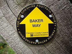
The Baker Way is a footpath running from Chester railway station to Delamere railway station within the English county of Cheshire. The total length of the trail is 13 miles (21 km). Its name commemorates the life and work of Jack Baker, a former footpaths officer for Cheshire County Council.
Contents
- Why go solar the baker way large financial savings
- Why go solar the baker way history good communication
- The route
- Sights
- References
Why go solar the baker way history good communication
The route
The Baker Way leaves Chester along the Shropshire Union Canal until bridge 120 at Christleton, where it then heads for Brown Heath before passing straight through Tarvin, along Hockenhull Lane and Tarvin High Street. It then crosses the A54 road and loops around the back of Ashton, just missing Mouldsworth. The path then crosses Church Road, Ashton, by the nearby St John the Evangelist's Church and then proceeds up Grange Road, which leads directly to the edge of Delamere Forest. The trail then passes by Fox Howl, the Forest's education centre, and crosses the Mid-Cheshire Line three times, the third time joining up with the Sandstone Trail for several hundred metres. The route then meanders through the forest to its end point at Delamere railway station. The route is shown on Ordnance Survey Explorer Maps 266 and 267.
Because the footpath starts and ends at railway stations, many walkers choose to park at one station, walk along the footpath to the opposite station and simply use the train to travel back again. There are very few waymarks along the footpath; for instance, there are no waymarks for the first few miles between Chester railway station and Christleton, making it very easy to lose the trail without careful use of a map.
Sights
Various sights are viewable along the Baker Way, such as Beeston Castle and Peckforton Castle, which can be seen from the fields surrounding Christleton and Brown Heath, and Ashton's church spire, which is a good landmark for navigation. Between Tarvin and Christleton the route crosses over the River Gowy at Hockenhull Platts, where there are three old packhorse bridges and a nature reserve.