Location Tibet, China Easiest route snow/ice/glacier climb First ascent 2009 Mountain range Himalayas | Parent range Kangri Garpo Elevation 6,882 m Prominence 2,444 m Listing Ultra-prominent peak | |
 | ||
Similar Gyala Peri, Mount Nyenchen Tanglha, Gurla Mandhata, Kawagarbo, Kula Kangri | ||
Bairiga (Chinese: 白日嘎; pinyin: Bái Rì Gä) or Ruoni (Chinese: 若尼峰; pinyin: Ruò Ní Fēng) (6,882 m) is the highest peak of Kangri Garpo Range of southeast Tibet. The region has only recently been explored and before 2009, none of its 47 peaks above 6,000 m had been climbed. Bairiga / Ruoni, which remains unclimbed itself, was photographed for the first time in 1933 by the botanist explorer Frank Kingdon-Ward, at which time it was known as Choembo.
Map of Bairiga, Zayu, Nyingchi, China
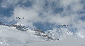
In 2009, a Sino-Japanese joint climbing team formed by China University of Geosciences (Wuhan) and Kobe University organized an expedition to climb Kangri Garpo II or Ruoni Ⅱ (6,805 m). On November 5, Deqing Ouzhu and Ciren Danda, Tibetan students with the CUG, were the first to reach the summit, while Koichiro Kondo and Masanori Yazaki scaled the peak two days later. In consultation with a local village leader Kangri Garpo II was renamed Lopchin (Lopchin Feng in Tibetan, Lou bu qin in Chinese), meaning "white male hawk".
