
Population 3,202 (2009 estimate) Sovereign state United Kingdom Local time Tuesday 3:51 PM | OS grid reference NS883819 Post town FALKIRK Dialling code 01324 | |
 | ||
Weather 9°C, Wind NW at 8 km/h, 52% Humidity | ||
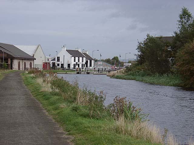
Bainsford is a small village within the Falkirk council area of Scotland. The village is situated in the Forth Valley, 1 mile (1.6 km) north of the town of Falkirk. It is positioned between the River Carron and the Forth and Clyde Canal to the north and south respectively.
Contents
Map of Bainsford, Falkirk, UK
The main road through the village is the B902 road which connects the village with Carron and Falkirk. Bainsford has a population of just over 3,000 residents according to a 2009 estimate.
History
The bridge crossing the Forth and Clyde Canal at Bainsford was originally a bascule bridge. In 1905, the bascule bridge was replaced by a heavier swing bridge to accommodate the new tramway. This in turn was replaced by a non-opening road bridge. Originally a separate village, Bainsford has now become part of the town of Falkirk.
Sports
In 1880 Bainsford Bluebonnets cricket club founded a football team called 'Bainsford Britannia' but changed their name to East Stirlingshire F.C. in 1881, which has remained ever since. The team played their home games at Merchiston Park, Bainsford. In recent times the team played their home games at Firs Park in Falkirk but now ground share with Stenhousemuir F.C. at Ochilview Park after leaving their old stadium in 2008.