
- elevation 367 m (1,204 ft) Basin area 103,577 km² | Length 650 km Basin area 103,577 km² | |
 | ||
- left Bahr Kameur River; Teté; Gourdai Countries | ||
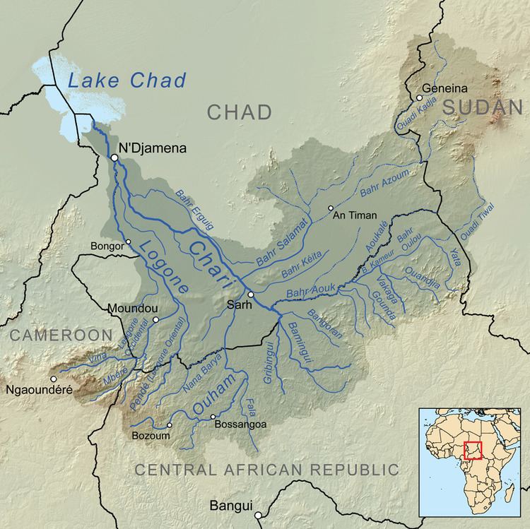
The Bahr Aouk River is a river in central Africa. It arises in eastern Chad at the border to Sudan and flows southwest, forming a significant portion of the international boundary between Chad and the Central African Republic. The Bahr Aouk meets the Chari River, which leaves the border and flows north into the Chad.
Contents
Map of Bahr Aouk
The average monthly flow of the river Bahr Aouk at hydrological station of Golongosso (in m³ / s )
(Calculated using the data for a period of 22 years, 1952–74)
Hydrometry
The flow of the river has been observed for over 22 years (1952–74) at Golongoso a town just short of the confluence with the Chari. The measured average annual flow during this period was 74 cubic metres per second (2,600 cu ft/s), draining an area of about 96,000 square kilometres (37,000 sq mi) which is a high proportion of the total catchment area of the river.
The average monthly flow of the river Bahr Aouk at hydrological station of Golongosso (in m³ / s )
(Calculated using the data for a period of 22 years, 1952–74)