
Area 22.93 km² | Intercommunality Région des Riceys Local time Tuesday 11:38 AM | |
 | ||
Weather 5°C, Wind S at 24 km/h, 86% Humidity Points of interest Champagne Paul-Marie Bertrand, Maucort-petitet Earl, Choisy Paul | ||
Bagneux-la-Fosse is a French commune in the Aube department in the Grand Est region of north-central France.
Contents
Map of 10340 Bagneux-la-Fosse, France
The inhabitants of the commune are known as Bagnolais or Bagnolaises.
Geography
Bagneux-la-Fosse is located some 40 km east of Saint-Florentin and 15 km south-west of Bar-sur-Seine. Access to the commune is by the D32 road from Avirey-Lingey in the north which passes through the village before continuing south to join the D452 which continues to Channes. The D17 goes west from the village the north-west to Pargues. The D26 branches off the D32 north-east of the village and goes north-east to Neuville-sur-Seine. There is a large forest in the north-west of the commune and a smaller forest in the south-east with the rest of the commune farmland.
The Sarce river flows through the commune from south to north just east of the village and continues north to join the Seine at Virey-sous-Bar.
Administration
List of Successive Mayors
(Not all data is known)
Demography
In 2010 the commune had 175 inhabitants. The evolution of the number of inhabitants is known from the population censuses conducted in the commune since 1793. From the 21st century, a census of communes with fewer than 10,000 inhabitants is held every five years, unlike larger communes that have a sample survey every year.
Sources : Ldh/EHESS/Cassini until 1962, INSEE database from 1968 (population without double counting and municipal population from 2006)
Sites and monuments
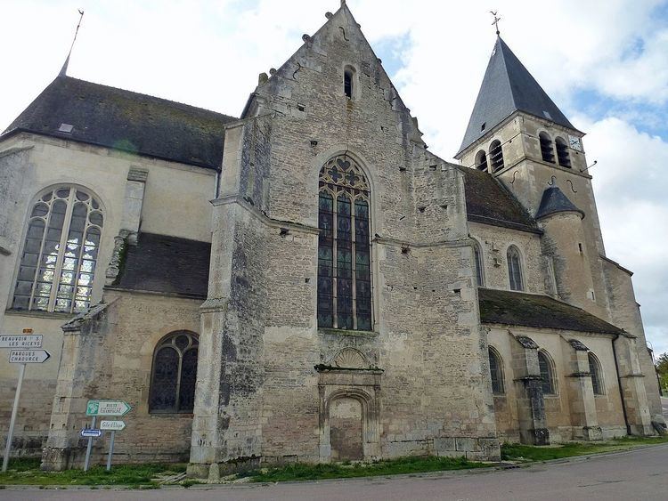
The Church (15th century) is registered as an historical monument. The church contains many items that are registered as historical objects: