
Vehicle registration UK | Time zone IST (UTC+5:30) Area 2,302 km² | |
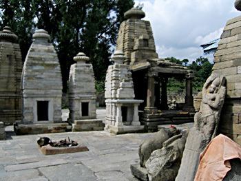 | ||
Named for shahi cevil network kaplote Points of interest Binsar Wildlife Sanctuary, Pindari Glacier, Bagnath Temple, Kausani Tea Estate, Kafni Glacier | ||
Bageshwar District is a district of Uttarakhand state in northern India. The town of Bageshwar is the district headquarters. The district of Bageshwar was established in the year 1997. Prior to this, Bageshwar was part of Almora district.
Contents
Map of Bageshwar, Uttarakhand
Bageshwar district is in the eastern Kumaon region of Uttarakhand, and is bounded on the west and northwest by Chamoli District, on the northeast and east by Pithoragarh District, and on the south by Almora District.
As of 2011 it is the third least populous district of Uttarakhand (out of 13), after Rudraprayag and Champawat.
Administration
For administrative convenience, Bageshwar is divided in four Tehsils,viz., Bageshwar--comprising 415 inhabited villages; 2) Kanda (with 180 inhabited villages); 3) Kapkot having 156 villages; and Garur having 197 revenue villages. Besides regular police at different Thanas like Bageshwar, Garur, Jhiroli, Kanda and Kapkot, Patwaris (revenue officials) are also equipped with police power. Pattis (viz., Katyur--Talla, Malla and Bichalla ; Dug; Kharahi; Danpur--Talla, Malla, Bichalla; Nakuri; Dafaut and Kamsyar--Walla and Palla) and Development BLOCKS are other administrative units.
Geography
From geographical point of view,Bageshwar district is hilly one--amidst Shivalik ranges and high Himalayas. Drainage system is from north to south-east. Main rivers flowing across Bageshwar are --Saryu/Sarju, Gomati, and Pungar, the latter two being tributary of Sarju. Many other riverines, locally known as GADHERA meet these at different places. These three river valleys have made alluvial landforms locally known as Seras where majority of population is concentrated. Other villages are settled on hillocks having mild slopes/ or some flat landforms.
Demographics
According to the 2011 census Bageshwar district has a population of 259,840, roughly equal to the nation of Vanuatu. This gives it a ranking of 578th in India (out of a total of 640). The district has a population density of 116 inhabitants per square kilometre (300/sq mi) . Its population growth rate over the decade 2001-2011 was 5.13%. Bageshwar has a sex ratio of 1093 females for every 1000 males, and a literacy rate of 80.69%.
As of 2001 Indian census, the Bagheswar district had a population of 249,462. Hindus 247,402, Muslims 1,280 (.51%), Christians 361.
Assembly Constituencies
- Kapkote
- Bageshwar (SC)