
Settlements 23 Postal code 24300 Area 596 km² | Time zone CET (UTC+1) Area code +381 24 Local time Tuesday 11:13 PM | |
 | ||
Weather 11°C, Wind S at 11 km/h, 60% Humidity | ||
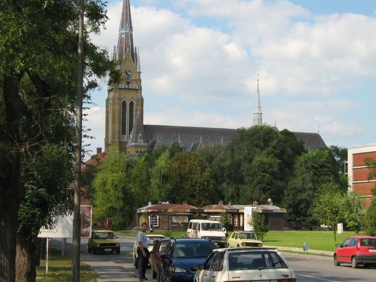
Bačka Topola (Serbian Cyrillic: Бачка Топола, [bâːtʃkaː topǒla]; Hungarian: Topolya, [ˈtopojɒ]) is a town and municipality located in the North Bačka District of the autonomous province of Vojvodina, Serbia. The municipality is composed of 23 local communities and has a population of 33,321, while the town itself has 14,573 inhabitants.
Contents
- Map of BaC48Dka Topola Serbia
- Name
- History
- Inhabited places
- Historical population of the town
- Ethnic groups in the municipality
- Settlements by ethnic majority
- Ethnic groups in the town
- Politics
- Famous people
- Sport
- Twin towns Sister cities
- References
Map of Ba%C4%8Dka Topola, Serbia
Name
The name of the town derived from the Serbian word topola (топола) ("poplar" in English). The first part of the name of the town was given to designate its location in the region of Bačka in the contrast to places with similar names, like Topola in Šumadija or Banatska Topola in Banat.
History
The town was mentioned first in 1462 under name Fibaych. This settlement was destroyed in the 16th century and new smaller settlement was later built at its location. Name Topola was first recorded in 1543, while according to the Ottoman defters from 1580, 1582, and 1590, it was mentioned as a village, whose population numbered between 21 and 23 houses. In this time, the inhabitants of the settlement were Serbs. In 1704, Topola was destroyed by kuruc rebels.
In 1731, Topola was mentioned as an uninhabited heath. In 1750, the new settlement was founded at this location and 200 Hungarian and Slovak families arrived here from Upper Hungary. It was a district center in Bács-Bodrog County as "Topolya" until 1918, when it became part of Kingdom of Serbs, Croats and Slovenes (renamed to Yugoslavia in 1929). It was part of Yugoslavia until 1991, with the exception of Hungarian occupation between 1941 and 1944 during World War II.
Inhabited places
Bačka Topola municipality includes the town of Bačka Topola and the following villages:
Note: For the inhabited places with an absolute or relative Hungarian ethnic majority, the names are also given in Hungarian.
Historical population of the town
Ethnic groups in the municipality
The population of the Bačka Topola municipality is composed of:
Settlements by ethnic majority
Local communities with a Hungarian majority are: Bačka Topola (Hungarian: Topolya), Bajša (Hungarian: Bajsa), Pačir (Hungarian: Pacsér), Stara Moravica (Hungarian: Bácskossuthfalva), Zobnatica (Hungarian: Andrásnépe), Bogaraš (Hungarian: Bogaras-Felváros), Obornjača (Hungarian: Nagyvölgy), Bagremovo (Hungarian: Brazília), Gunaroš (Hungarian: Gunaras), Novo Orahovo (Hungarian: Zentagunaras), and Kavilo (Hungarian: Rákóczifalu or Kavilló).
Local communities with a Serb majority are: Gornja Rogatica, Srednji Salaš, Panonija, Orešković, Bački Sokolac, Karađorđevo, Mićunovo, Njegoševo, Krivaja, Svetićevo, and Mali Beograd.
Pobeda (Hungarian: Győztes or Pobedabirtok) is an ethnically-mixed local community with a Hungarian relative majority. Krivaja, Mali Beograd, and Svetićevo have over 20% Hungarians, as well as other minorities, while Bačka Topola, Pačir, Zobnatica, and Pobeda have over 20% Serbs.
Ethnic groups in the town
The population of the Bačka Topola town is composed of:
Politics
Results of 2008 local elections in Bačka Topola municipality: [1]
Famous people
Sport
The most popular local football team is TSC Bačka Topola, that plays in the Bačka Zone League (4th national tier).
Twin towns — Sister cities
Bačka Topola is twinned with: