
North end: Fortaleza, Ceará | ||
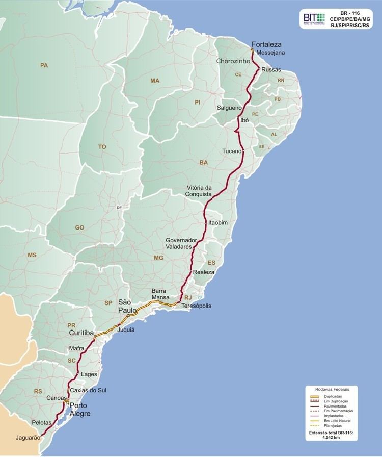 | ||
Length: 2,864.65 mi (4,610.21 km) Existed: 1951 (Rio-São Paulo)
1948 (Rio-Fortaleza)
1967-1977 (divided highways of Rodovia Presidente Dutra and Rodovia Régis Bittencourt) – present South end: Jaguarão, Rio Grande do Sul | ||
BR-116 is a federal highway of Brazil. One of the most important highways in Brazil and one of its longest, the 4,385 kilometres (2,725 mi) road connects Fortaleza to Jaguarão.
Contents
- Map of BR 116 Barra do Turvo SP 11955 000 Brazil
- Louco tira fino na carreta em plena dica de ultrapassagem br 116
- Route description
- References
Map of BR-116, Barra do Turvo - SP, 11955-000, Brazil
Louco tira fino na carreta em plena dica de ultrapassagem br 116
Route description
BR-116 runs in a north-south way, near, but not on Brazil's coastline. It is the major Brazilian highway, and it is the second longest of the country. Numerous stretches of the long path taken by the BR-116 have other official names.
The highway is especially busy along the Joinville-Curitiba-São Paulo-Rio de Janeiro section. The Curitiba-São Paulo section of the highway is known as Rodovia Régis Bittencourt, nicknamed "Rodovia da Morte" (Highway of death), due to its many accidents caused by the unstable weather conditions of the region. The São Paulo-Rio de Janeiro section is named Rodovia Presidente Dutra, and it is the busiest section of the highway, running into or near of 15 cities with more than 200.000 inhabitants.
Cities where the BR-116 runs or passes by: Fortaleza, Salgueiro, Feira de Santana, Vitória da Conquista, Teófilo Otoni, Governador Valadares, Rio de Janeiro, Volta Redonda, São José dos Campos, São Paulo, Curitiba, Lages, Canoas, Porto Alegre