
Country Vietnam Province Can Tho | Area 69 km² Local time Friday 12:37 AM | |
 | ||
Time zone Indochina Time (UTC+07:00) Weather 25°C, Wind E at 16 km/h, 75% Humidity | ||
nh b nh th y 4k atomos inferno sony a6300 canon 17 55 f2 8 hangocan h ng c n anhangoc
Bình Thủy is a district of Cần Thơ in the Mekong Delta region of Vietnam. His Khmer name is Kâmpoul Meas (កំពូលមាស). As of 2003 the district had a population of 87,665. The district covers an area of 69 km².
Contents
- nh b nh th y 4k atomos inferno sony a6300 canon 17 55 f2 8 hangocan h ng c n anhangoc
- Map of BC3ACnh ThE1BBA7y Can Tho Vietnam
- Ch a nam nh
- Administrative divisions
- Notable landmarks
- References
Map of B%C3%ACnh Th%E1%BB%A7y, Can Tho, Vietnam
Ch a nam nh
Administrative divisions
The district is divided into 8 wards (phường):
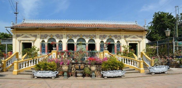
Notable landmarks
References
Bình Thủy District Wikipedia(Text) CC BY-SA