
Intercommunality Pays d'Olmes Area 26.94 km² Local time Thursday 6:03 PM | Region Occitanie Canton Lavelanet Time zone CET (UTC+1) Population 1,179 (1999) Arrondissement Foix | |
 | ||
Weather 16°C, Wind E at 11 km/h, 53% Humidity | ||
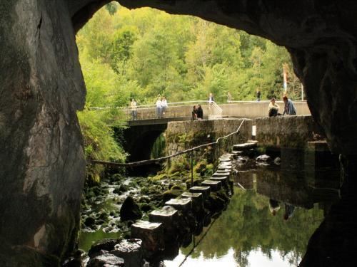
Bélesta (Occitan: Bèl Estar) is a commune, situated on the Hers-Vif river in the Ariège department of southwestern France.
Contents
Map of 09300 B%C3%A9lesta, France
History
Situated in the valley of the Hers-Vif, Bélesta is known for its fir tree forest, which was a former royal forest whose wood was used to construct the mast of ships. 1 km upstream from the village is a spring, created by a significant surge of water from the Karst Plateau de Sault.
References
Bélesta, Ariège Wikipedia(Text) CC BY-SA