
Local time Saturday 1:09 AM | ||
 | ||
Weather -10°C, Wind NW at 10 km/h, 87% Humidity | ||
Ayton is a community in the municipality of West Grey, Grey County, Ontario, Canada.
Map of Ayton, ON, Canada
Formerly the seat of local government for the disbanded Normanby Township, it is a rural village on the banks of the South Saugeen River and the center of a prosperous farming area. Located on the intersection of Grey Road 3 and Grey Road 9, Ayton is geographically south of Hanover, southwest of Durham, and a neighbour to Neustadt.
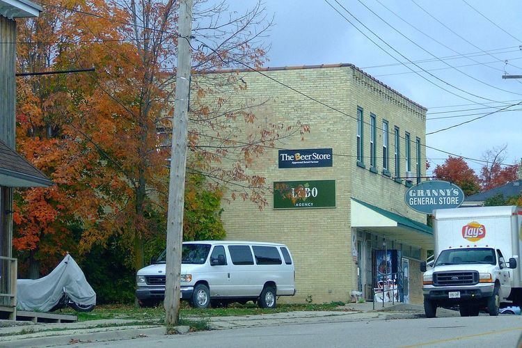
Although mostly a farming community, Ayton does have an arena (ice rink), Community Hall, Royal Bank, recreation hall, elementary school (Normanby Community School), Gr, (2 auto repair shops) Grein's Automotive, George's Service Centre, LCBO Outlet in Granny's General store (ATM), Trixie's Saloon (formerly Blondies Tavern) with billiards and home cooked meals, Lutheran Church, ELCIC, Pentecostal church, Roman Catholic Church. The old water powered mill, in the heart of the town, has a new career producing hydro for the grid instead of grist for the farmer. Ayton is the home of Fisher Poultry layers and pullets, Domm Construction, PM Graphics, Impressions Artistic Graphics and Design, Germania Mutual Insurance, Culbert Insurance Broker, Weppler Farm Machinery Ltd. repairing older farm and construction equipment and sales of new smaller shortline equipment, and Filsingers Organic Foods with 100 acres of orchards and a store with a selection of health foods, some of several major industries in West Grey. It is also known for camping at two local camp grounds (Riverplace and Silent Valley). Some small organic farms can be found and some hobby farms. Culture stems from mostly Germanic and Irish settlers, but also some Dutch 1950s, Swiss and Filipino 1990-2000s.