
Intercommunality Capcir Haut-Conflent Area 29.68 km² | Region Occitanie Canton Olette Population (2012) 44 | |
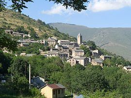 | ||
Ayguatébia-Talau (Catalan: Aiguatèbia i Talau) is a commune in the Pyrénées-Orientales department in southern France.
Contents
- Map of 66360 AyguatC3A9bia Talau France
- Localisation
- Toponymy
- History
- Architecture
- Notable people
- References
Map of 66360 Ayguat%C3%A9bia-Talau, France
Localisation
Ayguatébia-Talau is located in the canton of Olette and in the arrondissement of Prades.
Toponymy
The name of Ayguatébia appears in 958 as Aqua tebeda, immediately followed in 959 by Aquatepida. Villa Aque tepida is used during the 11th century and Aiguetevia is found in 1392. From the 17th century and on, the common forms are Aiguetebia and Ayguatebia. The modern spelling in Catalan is Aiguatèbia, but the traditional spelling, Ayguatèbia, should be preferred.
The name of Talau appears in 874 as Villa Talatio and in 876 as Talacho. Talazo, Talaz and Talaxo are used during the 10th century. Talau appears in the 13th century and is used since.
The name of Ayguatébia comes from the Latin aqua tebeda, meaning lukewarm water, in relation with warm springs found in Ayguatébia.
The name of Talau comes from a pre-Latin radical, Tal or Tala, meaning a small plateau found above a cliff or a hill, which corresponds to the situation of the village of Talau, located above the valley of the Cabrils river.
History
Ayguatébia-Talau is a town created on January 1, 1983 by uniting the towns of Ayguatébia and Talau.