
- location Yarqon Basin area 815 km² Bridges Jisr Jindas | Length 50 km | |
 | ||
Ayalon river park named project for tel aviv 2025
The Ayalon River (Hebrew: נחל איילון, Nahal Ayalon; Nahr el-Barideh or Wadi Musrara in Arabic) is a perennial stream in Israel and Palestine, originating in the Judean Hills and discharging into the Yarkon River in the area of Tel Aviv.
Contents
Map of Ayalon River
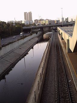
The total length of the Ayalon River is about 50 kilometres and it drains an area of 815 square kilometres. It begins in the Judean Hills northwest of Jerusalem near the Israeli settlements of Giv'at Ze'ev and Giv'on HaHadasha, flows down through the Ayalon Valley of the Shephelah region, reaches the Coastal Plain and passes near Ben Gurion Airport, is diverted from its original bed through an artificial concrete channel along the north-south Ayalon Freeway bordering central Tel Aviv on the east, and discharges into the Yarkon River in the Bavli quarter of Tel Aviv.
In the past the river discharged into the Mediterranean Sea north of Jaffa, but in order to prevent floods in residential areas its course was deviated and regulated. For further plans see here.
East of Tel Aviv the Ayalon passes through the grounds of the new Ariel Sharon Park, a grand project centered on the former Hiriya waste dump and since 2004 one of the biggest environmental rehabilitation projects in the world, designed by the German landscape architect Peter Latz and planned to be finalised by 2020.