
OS grid reference SU2370 Local time Friday 5:02 PM UK parliament constituency Devizes | Sovereign state United Kingdom Postcode district SN8 Dialling code 01672 | |
 | ||
Weather 10°C, Wind S at 16 km/h, 89% Humidity | ||
Axford is a hamlet in the Kennet Valley about 3 miles (4.8 km) east of Marlborough in the English county of Wiltshire.
Contents
Map of Axford, Marlborough, UK
History
Axford was one of seven Saxon settlements along the Kennet Valley in modern-day Wiltshire in the 5th and 6th centuries.
During the 15th and 16th century, Axford Manor was centred on Priory Farm a short distance from the village itself. The majority of housing was built to the south of the main road through the village; the area to the north was developed during the late 18th and early 19th century.
A military camp was located near Axford during the Second World War.
Buildings
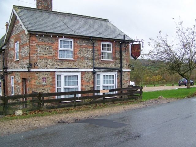
Axford contains one listed building; the Grade 1 listed Axford Farmhouse. A church is located in the village. It also contains The Red Lion public house, a 17th-century building.
Local government
Axford is in Ramsbury and Axford civil parish, which is in the area of Wiltshire Council. The two councils are responsible for different aspects of local government.
Transport
Axford is located a short distance from the A4 road. Bus services to the village are provided by Thamesdown Transport route 48 between Swindon and Marlborough.
Position: grid reference SU238701