
 | ||
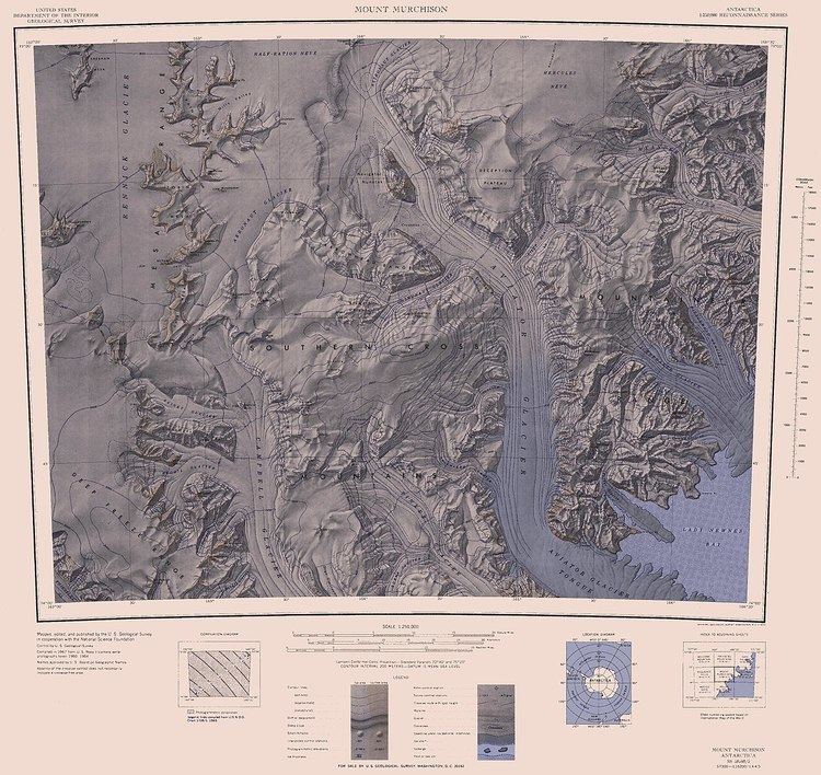
Aviator Glacier is major valley glacier in Antarctica that is over 60 miles (96 km) long and 5 miles (8 km) wide, descending generally southward from the plateau of Victoria Land along the west side of Mountaineer Range, and entering Lady Newnes Bay between Cape Sibbald and Hayes Head where it forms the Aviator Glacier Tongue.
Contents
Map of Aviator Glacier, Antarctica
A glacier is a mass of ice with sufficient thickness to flow away from the source area in lobes, tongues or masses. Glaciers are usually found at high altitudes or high elevations.
The glacier was photographed from the air by Capt. W.M. Hawkes, US Navy, on the historic first flight from New Zealand to McMurdo Sound on December 17, 1955. An attempt to reconnoiter it by helicopter and to land a party of the NZGSAE on it had to be abandoned when the USS Glacier was damaged in pressure ice in December 1958. Named by NZGSAE, 1958–59, as a tribute to the hazardous work of pilots and other airmen in Antarctic exploratory and scientific operations.
Aviator Glacier Tongue
The Aviator Glacier Tongue in Antarctica is a seaward extension of Aviator Glacier into the Ross Sea, between Wood Bay and Lady Newness Bay along the coast of Victoria Land. This floating ice tongue extends into the water for about 25 kilometres (16 mi). The name was recommended by the Advisory Committee on Antarctic Names (US-ACAN) in association with Aviator Glacier.