Time zone CET (UTC+1) Local time Friday 8:06 AM | Intercommunality Pays Châtillonnais Area 26.77 km² Population 133 (1999) | |
 | ||
Region Bourgogne-Franche-Comté Weather 6°C, Wind SE at 16 km/h, 75% Humidity | ||
Autricourt is a French commune in the Côte-d'Or department in the Bourgogne-Franche-Comté region of eastern France.
Contents
- Map of 21570 Autricourt France
- Geography
- History
- Administration
- Demography
- Civil heritage
- Religious heritage
- Environmental heritage
- Notable people linked to the commune
- References
Map of 21570 Autricourt, France
The inhabitants of the commune are known as Astricurtois or Astricurtoises.
Geography
Autricourt is located some 55 km south-east of Troyes and 22 km north by north-east of Châtillon-sur-Seine. The northern border of the commune is the departmental border between Côte-d'Or and Aube. Access to the commune is by the D13 road from Grancey-sur-Ource in the north-west passing through the centre of the commune and the village and continuing south-east to Belan-sur-Ource. Much of the commune in the north and south is heavily forested however the centre of the commune is farmland.
The Ource river flows through the centre of the commune from south-east to north-west before it continues north-west to join the Seine at Merrey-sur-Arce. The Ruisseau de Beaumont flows from the north-east towards the south-west to join the Ource in the commune.
History
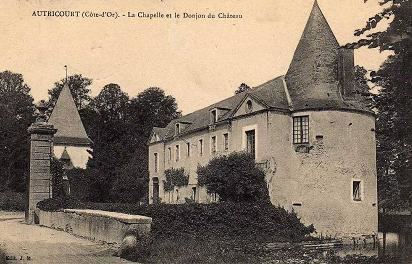
The village has Celtic origins with ditches and embankments that have been observed near the present village. In the hamlet of Champigny Gallic tombs have been found. The name Autricourt came from the Frankish era and was the name of a landowner: Auster with curtis meaning "domain". Araound the 11th century a feudal fief was created as evidenced by the presence of the castle and which later came under the rule of the Dukes of Burgundy.
Administration
List of Successive Mayors
(Not all data is known)
Demography
In 2010 the commune had 122 inhabitants. The evolution of the number of inhabitants is known from the population censuses conducted in the commune since 1793. From the 21st century, a census of communes with fewer than 10,000 inhabitants is held every five years, unlike larger communes that have a sample survey every year.
Sources : Ldh/EHESS/Cassini until 1962, INSEE database from 1968 (population without double counting and municipal population from 2006)
Civil heritage
The commune has a number of buildings and structures that are registered as historical monuments:
Religious heritage
The commune has many religious buildings and structures that are registered as historical monuments:
The Church of Saint-Valentin contains many items that are registered as historical objects:
Environmental heritage
Because of its efforts to raise the quality of its nocturnal environment the commune was labeled a "2 star Village" in 2013. The label is awarded by the National Association for the Protection of the sky and nocturnal environment (ANPCEN) and has 5 levels. A panel is displayed at the entrance to the village to show this distinction.
