
 | ||
North end Barrio La Caro, Vereda Fusca, Chía | ||
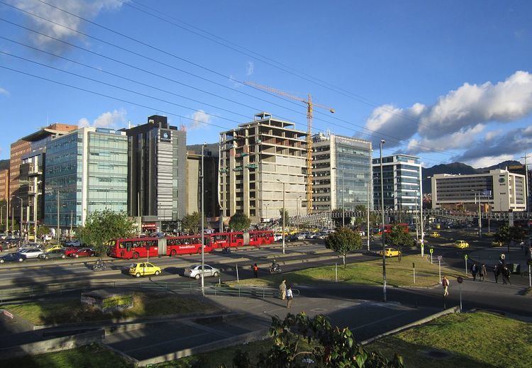
Autopista Norte, also called Autopista paseo de los libertadores (Way of the Liberators Highway), is a major road in Bogotá, Colombia, running through the northern part of the city to its southern end at Avenida Caracas.
Contents
Map of Autopista Nte., Antioquia, Colombia
Names
The road was opened in 1956 and was named Autopista Norte until Calle 100. From that point north, it was known as Autopista paseo de los libertadores until the city of Tunja. Some time later, the name Autopista Norte came to mean the stretch of the road from its southerly beginning until Calle 194.
Due to changes in nomenclature and the urban expansion of the city to the north, the name was changed to Avenida 13 and was changed again in 2006 to Avenida Carrera 45.
Route
The road begins in the Los Héroes monument between the Barrios Unidos and Chapinero localities and continues north. In its median is a line of the TransMilenio mass-transit system to Portal del Norte on Calle 170. It continues north to La Caro in Chia.
Between 180th and 192nd streets the Autopista has been reconstructed. As of 2010, it has 5 lanes each way and 1 extra lane in the middle for a Transmilenio expansion towards the north.