
 | ||
An automotive navigation system is part of the automobile controls or a third party add-on used to find direction in an automobile. It typically uses a satellite navigation device to get its position data which is then correlated to a position on a road. When directions are needed routing can be calculated. On the fly traffic information can be used to adjust the route.
Contents
- History
- Technology
- Navigation Data Standard NDS
- Media
- Real time data
- Integration and other functions
- Original factory equipment
- SMS
- References
Dead reckoning using distance data from sensors attached to the drivetrain, a gyroscope and an accelerometer can be used for greater reliability, as GPS signal loss and/or multipath can occur due to urban canyons or tunnels.
History
Automotive navigation systems represent a convergence of a number of diverse technologies many of which have been available for many years, but were too costly or inaccessible. Limitations such as batteries, display, and processing power had to be overcome before the product became commercially viable. Etak made an early system that used map-matching to improve on dead reckoning instrumentation. Digital map information was stored on standard cassette tapes.
Technology
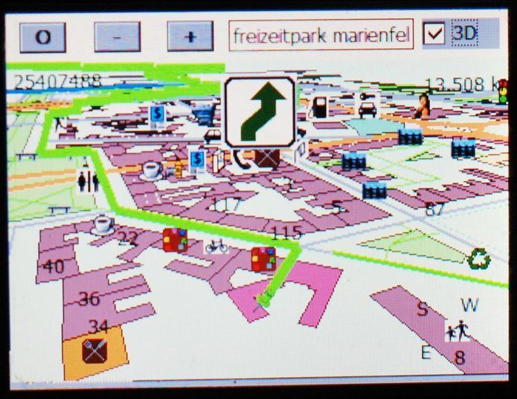
The road database is a vector map. Street names or numbers and house numbers are encoded as geographic coordinates so that the user can find some desired destination by street address (see map database management).
Points of interest (waypoints) are stored with their geographic coordinates. Formats are almost uniformly proprietary; there is no industry standard for satellite navigation maps, although some companies are trying to address this with SDAL and NDS.
Map data vendors such as Tele Atlas and Navteq create the base map in a Geographic Data Files format, but each electronics manufacturer compiles it in an optimized, usually proprietary format. GDF is not a CD standard for car navigation systems. GDF is used and converted onto the CD-ROM in the internal format of the navigation system.
CARiN Database Format (CDF) is a proprietary navigation map format created by Philips Car Systems (this branch was sold to Mannesman VDO, which became VDO/Dayton in 1998, then Siemens VDO in 2002, then Continental in 2007) and is used in a number of navigation-equipped vehicles. The 'CARiN' portmanteau is derived from Car Information and Navigation.
SDAL is a proprietary map format published by Navteq, who released it royalty free in the hope that it would become an industry standard for digital navigation maps. Vendors who used this format include:
The format has not been very widely adopted by the industry.
Navigation Data Standard (NDS)
The Navigation Data Standard (NDS) initiative, is an industry grouping of car manufacturers, navigation system suppliers and map data suppliers whose objective is the standardization of the data format used in car navigation systems, as well as allow a map update capability. The NDS effort began in 2004 and became a registered association in 2009. Standardization would improve interoperability, specifically by allowing the same navigation maps to be used in navigation systems from 20 manufacturers. Companies involved include BMW, Volkswagen, Daimler, Renault, ADIT, Aisin AW, Alpine Electronics, Navigon, Navis-AMS, Bosch, DENSO, Mitsubishi, Harman International Industries, Panasonic, Preh Car Connect formerly TechniSat, PTV, Continental AG, Clarion, Navteq, Navinfo, TomTom and Zenrin.
Media
The road database may be stored in solid state read-only memory (ROM), optical media (CD or DVD), solid state flash memory, magnetic media (hard disk), or a combination. A common scheme is to have a base map permanently stored in ROM that can be augmented with detailed information for a region the user is interested in. A ROM is always programmed at the factory; the other media may be preprogrammed, downloaded from a CD or DVD via a computer or wireless connection (bluetooth, Wi-Fi), or directly used utilizing a card reader.
Some navigation device makers provide free map updates for their customers. These updates are often obtained from the vendor's website, which is accessed by connecting the navigation device to a PC.
Real-time data
Some systems can receive and display information on traffic congestion using either TMC, RDS, or by GPRS/3G data transmission via mobile phones.
Integration and other functions
Original factory equipment
Many vehicle manufacturers offer a GPS navigation device as an option in their vehicles. Customers whose vehicles did not ship with GPS can therefore purchase and retrofit the original factory-supplied GPS unit. In some cases this can be a straightforward "plug-and-play" installation if the required wiring harness is already present in the vehicle. However, with some manufacturers, new wiring is required, making the installation more complex.
The primary benefit of this approach an integrated and factory-standard installation. Many original systems also contain a gyrocompass or accelerometer and may accept input from the vehicle's speed sensors, thereby allowing them to navigate via dead reckoning when a GPS signal is temporarily unavailable. However, the costs can be considerably higher than other options.
SMS
Establishing points of interest in real-time and transmitting them via GSM cellular telephone networks using the Short Message Service (SMS) is referred to as Gps2sms. Some vehicles and vessels are equipped with hardware that is able to automatically send an SMS text message when a particular event happens, such as theft, anchor drift or breakdown. The receiving party (e.g., a tow truck) can store the waypoint in a computer system, draw a map indicating the location, or see it in an automotive navigation system.