
Country United States FIPS code 01-03220 Elevation 49 m Population 864 (2013) Area code 334 | Time zone Central (CST) (UTC-6) GNIS feature ID 0113299 Zip code 36003 Local time Thursday 6:15 PM | |
 | ||
Weather 14°C, Wind N at 10 km/h, 27% Humidity Area 20.2 km² (19.7 km² Land / 50 ha Water) | ||
George wild child butler autaugaville alabama u s a the best of wild child instr
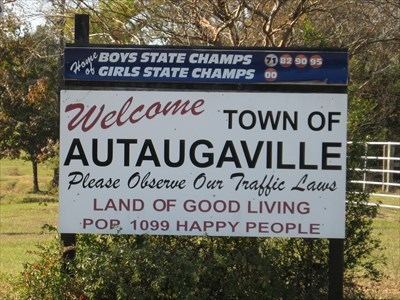
Autaugaville is a town in Autauga County, Alabama, United States. At the 2010 census the population was 870. It is part of the Montgomery Metropolitan Statistical Area.
Contents
- George wild child butler autaugaville alabama u s a the best of wild child instr
- Map of Autaugaville AL USA
- Help autaugaville alabama traffic speeding ticket lawyer best autaugaville al traffic attorney
- Geography
- Nearby towns
- 2010 Census data
- 2000 Census data
- Education
- Notable people
- References
Map of Autaugaville, AL, USA
Help autaugaville alabama traffic speeding ticket lawyer best autaugaville al traffic attorney
Geography
Autaugaville is located at 32°25′57″N 86°39′32″W (32.432563, -86.658752).
According to the U.S. Census Bureau, the town has a total area of 7.8 square miles (20 km2), of which, 7.6 square miles (20 km2) of it is land and 0.2 square miles (0.52 km2) of it is water.
Nearby towns
- White Hall, Alabama
- Lowndesboro, Alabama
- Prattville, Alabama
- Benton, Alabama
- Billingsley, Alabama
- Hayneville, Alabama
- Mosses, Alabama
- Gordonville, Alabama
2010 Census data
As of the census of 2010, there were 870 people, 350 households, and 243 families residing in the town. The population density was 114.2 people per square mile (44.1/km2). There were 412 housing units at an average density of 54.1 per square mile (20.9/km2). The racial makeup of the town was 66.8% Black or African American, 31.3% White, 0.2% Native American, 0.3% from other races, and 1.4% from two or more races. 0.8% of the population were Hispanic or Latino of any race.
There were 350 households of which 29.4% had children under the age of 18 living with them, 38.6% were married couples living together, 4.9% had a male householder with no wife present, 26.0% has a female householder with no husband present, and 30.6% were non-families. 26.6% of all households were made up of individuals. The average household size was 2.49 and the average family size was 3.00.
In the town, the population was spread out with 27.1% under the age of 18, 8.5% from 18 to 24, 27.9% from 25 to 44, 24.6% from 45 to 64, and 11.9% who were 65 years of age or older. The median age was 36.3 years. For every 100 females there were 91.1 males. For every 100 females age 18 and over, there were 87.6 males.
2000 Census data
As of the census of 2000, there were 820 people, 316 households, and 219 families residing in the town. The population density was 106.1 people per square mile (41.0/km2). There were 384 housing units at an average density of 49.7 per square mile (19.2/km2). The racial makeup of the town was 65.98% Black or African American, 32.32% White, 0.24% Native American, 0.24% from other races, and 1.22% from two or more races. 0.98% of the population were Hispanic or Latino of any race.
There were 316 households out of which 34.5% had children under the age of 18 living with them, 39.6% were married couples living together, 25.0% had a female householder with no husband present, and 30.4% were non-families. 28.5% of all households were made up of individuals and 13.6% had someone living alone who was 65 years of age or older. The average household size was 2.59 and the average family size was 3.18.
In the town, the population was spread out with 31.1% under the age of 18, 8.9% from 18 to 24, 26.5% from 25 to 44, 20.2% from 45 to 64, and 13.3% who were 65 years of age or older. The median age was 33 years. For every 100 females there were 86.4 males. For every 100 females age 18 and over, there were 78.8 males.
The median income for a household in the town was $22,563, and the median income for a family was $35,417. Males had a median income of $29,688 versus $19,821 for females. The per capita income for the town was $12,586. 27.1% of the population and 27.4% of families were below the poverty line. 31.2% of those under the age of 18 and 23.2% of those 65 and older are living below the poverty line.
Education
Autaugaville is part of the Autauga County School System and is home to Autaugaville School for prekindergarten to grade 12 students.