
Country India District Latur Time zone IST (UTC+5:30) Elevation 634 m Local time Thursday 7:45 PM | State Maharashtra Taluka Ausa PIN 413520 Population 36,118 (2011) | |
 | ||
Weather 29°C, Wind S at 5 km/h, 22% Humidity Neighborhoods Ansar Nagar, Katghar Mohalla, Sanjay Nagar, Gopalpur | ||
Nagarpalika ransangram ausa latur 12th december 2016
Ausa is a town with a municipal council in Latur District in the state of Maharashtra, India. It is also the headquarters for Ausa Taluka.
Contents
- Nagarpalika ransangram ausa latur 12th december 2016
- Map of Ausa Maharashtra 413520
- Frozen in summer song official hd
- Geography
- History
- Agriculture
- SAM ComputeroniX
- Demographics
- References
Map of Ausa, Maharashtra 413520
Frozen in summer song official hd
Geography
Ausa is located at 18.25°N 76.5°E / 18.25; 76.5. It has an average elevation of 634 metres (2080 feet).
History
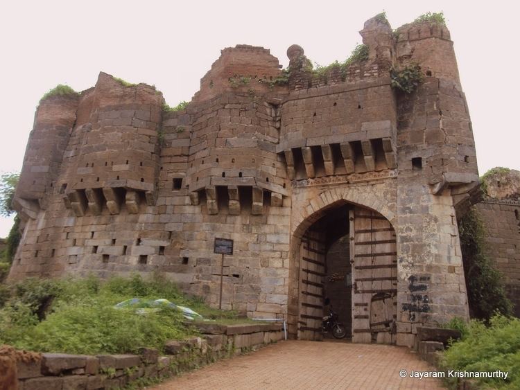
When Ausa was a Taluka, the recent Latur district place was a just part of this big Ausa Taluka. Ausa is as it is, but, Latur developed as a big city and a district place having more than 5 lac population. Ausa has an ancient fort. It was developed in es1200.and one of temple name is malynath maharaj
Agriculture
Around the Killari area, grape production is large and is an important export. In the Almala village are famous for production in Sugarcane. Bhada village is famous for producing carrots in whole district. The major river in Ausa is Tavaraja and Terana. It is a large market for livestock like cows, buffaloes, goats in both the Latur and Osmanabad districts. There is a need of APMC market in ausa.
SAM ComputeroniX
The First Computer Shop In Ausa. "SAM Computeronix",Computer Sales And Services, Hashmi Nagar, Hashmi Chowk, Ausa.413520
Demographics
As of 2001 India census, Ausa had a population of 30,876. Males constitute 51% of the population and females 49%. 16% of the population is under 6 years of age. Marathi and Kannada and Hindi are widely understood by the people here.