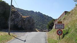
Local time Thursday 2:01 PM | Region Occitanie Arrondissement Carcassonne Area 20.93 km² | |
 | ||
Intercommunality Région Lézignanaise, Corbières et Minervois Weather 14°C, Wind NW at 10 km/h, 57% Humidity | ||
Auriac is a French commune in the Aude department in the Occitanie region of southern France.
Contents
- Map of 11330 Auriac France
- Geography
- Administration
- Demography
- Civil heritage
- Religious heritage
- References
Map of 11330 Auriac, France
The inhabitants of the commune are known as Auriacois or Auriacoises.
Geography
The commune is located in the Corbières some 35 km south-east of Limoux and 15 km east of Arques. Access to the commune is by the D212 road which branches from the D613 west of Mouthoumet and goes south through the commune by a tortuous route then continues south to join the D10 north-east of Soulatgé. Apart from the village there are the hamlets of Savugnan in the south-west and La Grave north of the village. The whole of the commune is rugged and heavily forested.
Many streams rise all over the commune and flow northwards to join the Orbieu which flows through the commune from south-west to north to eventually join the Aude near Raissac-d'Aude.
Administration
List of Successive Mayors
(Not all data is known)
Demography
In 2010 the commune had 32 inhabitants. The evolution of the number of inhabitants is known from the population censuses conducted in the commune since 1793. From the 21st century, a census of communes with fewer than 10,000 inhabitants is held every five years, unlike larger towns that have a sample survey every year.
Sources : Ldh/EHESS/Cassini until 1962, INSEE database from 1968 (population without double counting and municipal population from 2006)
Civil heritage
The commune has one building that is registered as an historical monument:
Religious heritage
The commune has one religious building that is registered as an historical monument:
