
Area 54.68 km² | Region Occitanie Population (2010) 165 Local time Thursday 1:55 PM | |
 | ||
Weather 8°C, Wind W at 13 km/h, 89% Humidity | ||
Aurelle-Verlac (Occitan: Aurela Verlac) is a former commune in the Aveyron department in the Occitanie region of southern France. On 1 January 2016, it was merged into the new commune of Saint-Geniez-d'Olt-et-d'Aubrac.
Contents
- Map of 12130 Aurelle Verlac France
- Beton imprime aurelle verlac 12130 france www betonimprimeart fr youtube
- Geography
- Administration
- Demography
- Civil heritage
- Religious heritage
- References
Map of 12130 Aurelle-Verlac, France
The inhabitants of the commune are known as Aurellacois or Aurellacoises.
Beton imprime aurelle verlac 12130 france www betonimprimeart fr youtube
Geography
Aurelle-Verlac is located in the Massif Central in Aubrac some 60 km east of Decazeville and 70 km south-east of Aurillac with the eastern border of the commune being the border between Aveyron and Lozère departments. Access to the commune is by road D503 from Saint-Geniez-d'Olt in the south which goes north through the village and most of the length of the commune before going west to join the D219 west of the commune. Apart from the village there are the hamlets of Crespiac, Verelaguet, Les Mazes, La Frassinede, Naves d'Aubrac, La Molière, Moncan, Rieuzens, Bernie, Les Caps, and Les Ginestes. The commune is mainly deep valleys where boraldes flow down to the Lot. The highest point in the department is on the Signal de Mailhe-Biau in the north-east of the commune. It is located in a Natura 2000 zone and is rugged with forests and high country farming.
The Ruisseau de Mardonenque rises in the north and flows south down the centre of the commune gathering tributaries including the Ruisseau de Monette, the Ravin de Placaus, the Ravin des Rives, the Ravin de la Coste, the Ravin de la Ligue, and the Ruisseau de Rioubasset, which forms the south-eastern border, before continuing south to join the Lot near Saint-Geniez-d'Olt. The Ruisseau de Bonance also rises in the north of the commune and flows south towards the eastern side of the commune forming part of the eastern border before continuing south to join the Lot near Pomayrols. On the western side of the commune the Merdanson forms the western border of the commune as it flows south to join the Lot near Cabanac. The Ruisseau de Rioudis and the Ruisseau de Mandialou both rise in the commune and join the Merdanson on the western border.
Administration
List of Successive Mayors
(Not all data is known)
Demography
In 2010 the commune had 165 inhabitants. The evolution of the number of inhabitants is known from the population censuses conducted in the commune since 1793. From the 21st century, a census of communes with fewer than 10,000 inhabitants is held every five years, unlike larger towns that have a sample survey every year.
Sources : Ldh/EHESS/Cassini until 1962, INSEE database from 1968 (population without double counting and municipal population from 2006)
Civil heritage
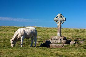
Religious heritage
The commune has two religious buildings that are registered as historical monuments: