
OS grid reference TF021146 | Sovereign state United Kingdom Postcode district PE9 | |
 | ||
Aunby is a village in the parish of Careby Aunby and Holywell (where the population is included), in the South Kesteven district of Lincolnshire, England. It is situated north from Stamford on the B1176 road, and just south of Careby.
Map of Aunby, Stamford, UK
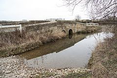
Aunby consists of Manor and Lodge farms, and a deserted medieval village. The River Glen flows to the east of the village, next to the East Coast Main Line. Close to the west is Rutland.
References
Aunby Wikipedia(Text) CC BY-SA