
Population 193 (2011 census) Postal code 4311 | Postcode(s) 4311 | |
 | ||
Location 20 km (12 mi) S of Esk60 km (37 mi) W of Brisbane | ||
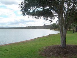
Atkinsons Dam is a rural locality in the Somerset Region, Queensland, Australia. It is known for the Atkinson Dam which occupies most of the locality. In the 2011 census, Atkinson Dam had a population of 193 people.
Contents
Map of Atkinsons Dam QLD 4311, Australia
The northern boundary of the locality is marked by Buaraba Creek, a tributary of Lockyer Creek.
History
Atkinson's Lagooon Provisional School opened on 6 August 1885. On 1 January 1909, it was upgraded to a State School. It closed in 1968.
References
Atkinsons Dam, Queensland Wikipedia(Text) CC BY-SA