
Census Area Aleutians West Area code(s) 907 Population 66 (2013) Local time Tuesday 11:31 AM | Incorporated 1988 Elevation 18 m Zip code 99547 | |
 | ||
Time zone Hawaii-Aleutian (HST) (UTC-10) Weather 3°C, Wind E at 50 km/h, 61% Humidity | ||
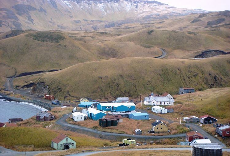
Atka (Unangax̂: Atx̂ax̂) is a hamlet located on the east side of Atka Island, in Aleutians West Census Area, Alaska, United States. The population was 61 at the 2010 census.
Contents
Map of Atka, AK, USA
The population of Atka is nearly entirely Aleut (Unangan). The major industry is fishing.
Geography
Atka is located at 52°11′57″N 174°12′48″W (52.199271, -174.213398).
According to the U.S. Census Bureau, the hamlet has a total area of 36.2 square miles (94 km2), of which, 8.7 square miles (23 km2) of it is land and 27.4 square miles (71 km2) of it (75.81%) is water.
Atka is formed by a shield volcano, with a number of outlets. The highest point on Atka is Korovin Volcano, which last erupted in 2006.
Demographics
As of the census of 2000, there were 92 people, 32 households, and 20 families residing in the hamlet. The population density was 10.5 people per square mile (4.1/km²). There were 41 housing units at an average density of 4.7 per square mile (1.8/km²). The racial makeup of the hamlet was 80.43% Native American, 6.52% White, 1.09% Asian, 1.09% Pacific Islander, and 10.87% from two or more races. 1.09% of the population were Hispanic or Latino of any race.
There were 32 households out of which 40.6% had children under the age of 18 living with them, 37.5% were married couples living together, 9.4% had a female householder with no husband present, and 34.4% were non-families. 28.1% of all households were made up of individuals and 9.4% had someone living alone who was 65 years of age or older. The average household size was 2.69 and the average family size was 3.33.
In the hamlet the population was spread out with 30.4% under the age of 18, 7.6% from 18 to 24, 29.3% from 25 to 44, 23.9% from 45 to 64, and 8.7% who were 65 years of age or older. The median age was 36 years. For every 100 females there were 100.0 males. For every 100 females age 18 and over, there were 106.5 males.
The median income for a household in the hamlet was $30,938, and the median income for a family was $34,375. Males had a median income of $28,750 versus $33,438 for females. The per capita income for the hamlet was $17,080. There were no families and 7.5% of the population living below the poverty line, including no under eighteens and 26.7% of those over 64.
Atka Airport is the island's only airstrip.
Education
Atka is served by the Aleutian Region Schools.
The Yakov E. Netsvetov School serves grades K-12.