
Local time Wednesday 10:12 AM | ||
 | ||
Weather 19°C, Wind NW at 3 km/h, 82% Humidity | ||
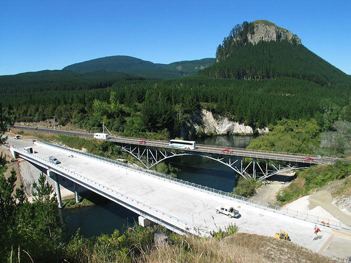
Atiamuri is a former Hydro village in the central North Island of New Zealand. It lies alongside State Highway One about 45 km north of Taupo. It is bordered by the Waikato River and surrounded by pine plantations. Upper Atimauri, just north of the Waikato River, is a small community of lifestyle blocks, dairy farms and farm servicing businesses.
Contents
Map of Atiamuri, New Zealand
Mount Pōhaturoa (520 m) is a distinctive volcanic plug that dominates the Atiamuri landscape. It overlooks Lake Atiamuri which was formed behind the hydroelectric Atiamuri Power Station. This very visible rocky outcrop is significant in both Arawa and Ngati Raukawa history, having been a strategic observation post during intertribal conflicts.
Lake Atiamuri was formed by the Atiamuri hydroelectric power station after it was completed in 1958. The lake extends about 5 km upstream towards Taupo before meeting the Ohakuri Hydro Dam. The area offers some great trout fishing.
Atiamuri Power Station
Atiamuri Power Station is a hydroelectric power station on the Waikato River owned by Mercury Energy. It has a total capacity of 84 MW and was first commissioned in 1958.