
OS grid reference ST348288 Post town BRIDGWATER Local time Tuesday 3:48 AM | Sovereign state United Kingdom Postcode district TA6 Dialling code 01278 | |
 | ||
Weather 1°C, Wind SW at 8 km/h, 98% Humidity UK parliament constituency Bridgwater and West Somerset | ||
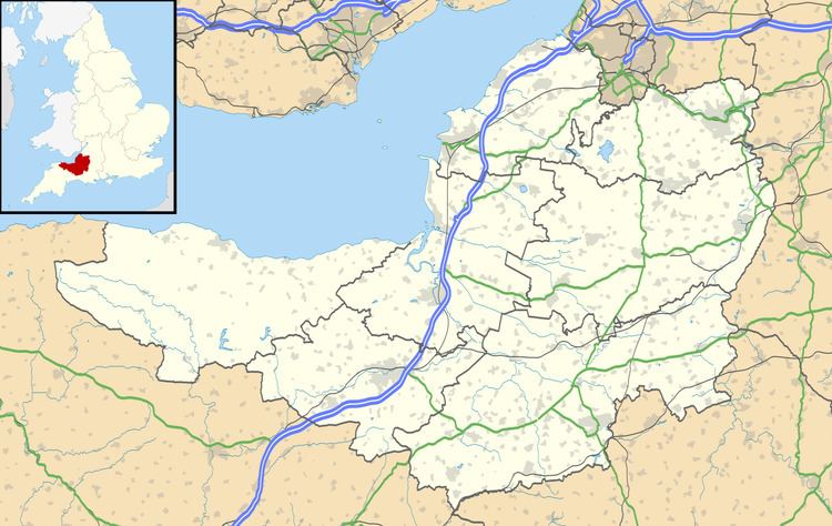
Athelney is located between the villages of Burrowbridge and East Lyng in the Sedgemoor district of Somerset, England. The area is known as the Isle of Athelney, because it was once a very low isolated island in the 'very great swampy and impassable marshes' of the Somerset Levels. Much of the Levels are below the level of high tide. They are now drained for agricultural use during the summer, but are regularly flooded in the winter.
Contents
Map of Athelney, Bridgwater, UK
Athelney is around 6 miles from North Petherton, where the Alfred Jewel (an Anglo-Saxon ornament dating from the late 9th century) was discovered in 1693.
Isle of Athelney
The Isle of Athelney is best known for once being the fortress hiding place of King Alfred the Great, from where he went on to defeat the Danes at the Battle of Edington in May 878.
Archaeological excavations and written evidence indicate that at the time of Alfred the island was linked by a causeway, known as Balt Moor Wall to East Lyng, with either end protected by a semi-circular stockade and ditch. The ditch on the island is now known to date from the Iron Age. It is therefore presumed that the Isle was known by Alfred to have been an ancient fort, and that its existing defences were strengthened by him. Evidence of metalworking on the site suggests that he also used the island to equip his army.
When translated from the Anglo-Saxon, the name of the isle, Æthelinga íeg, is often thought to mean the Island of Princes; if correct this might suggest that the island had royal connections prior to Alfred.
To give thanks for his victory, Alfred founded a monastery, Athelney Abbey, on the Isle in 888, which lasted until the Dissolution of the Monasteries under Henry VIII in 1539, when the value of the rubble was put at £80.
After Athelney Abbey was dissolved the monks then built the church in the neighbouring village of East Lyng.
There are no remains of the monastery above ground, but excavations were carried out as part of the first and 100th Time Team television archaeology programmes.
The monastery's location was marked by a small monument on top of the isle in 1801 built by Sir John Slade, 1st Baronet of the Slade Baronets, on the site of a stone vault. It is a Scheduled Ancient Monument (Somerset County No 367) and Grade II listed building. The monument is now on private land belonging to Athelney Farm and, although visible from a layby off the A361, is not accessible to the public.