
Country India District Guntur Time zone IST (UTC+5:30) Population 58,447 (2011) | State Andhra Pradesh Headquarters Atchampet Area 191.2 km² Government body Panchayat Samiti | |
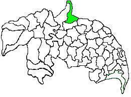 | ||
Atchampet mandal (officially Atchampet H/O Chamarru) is one of the 57 mandals in Guntur district of the Indian state of Andhra Pradesh. The mandal is under the administration of Guntur revenue division and the headquarters are located at Atchampet. The mandal is located on the banks of Krishna River, at a distance 68 km from the district headquarters. It is bounded by Amaravathi, Krosuru, Pedakurapadu, Bellamkonda and Sattenapalli mandals.
Contents
Demographics
As of 2011 census, the mandal had a population of 58,447. The total population constitute, 29,749 males and 28,698 females —a sex ratio of 965 females per 1000 males. 6,676 children are in the age group of 0–6 years.
Towns and villages
As of 2011 census, the mandal has 18 villages.
The settlements in the mandal are listed below:
Administration
The mandal is under the control of a tahsildar and the present tahsildar is G.Sujatha. Atchampet mandal is one of the 5 mandals under Pedakurapadu (Assembly constituency), which in turn represents Narasaraopet (Lok Sabha constituency) of Andhra Pradesh.