
Operator Israel Defense Forces Elevation AMSL 2,485 ft / 757 m Address Jerusalem Elevation 757 m | Location Jerusalem 12/30 6,447 Code JRS Opened 1920 | |
 | ||
Airport type Military (and formerly: joint Public) Closed October 2000 (2000-10) (closed to civilian traffic) Similar Atarot Industrial Zone, Giv'at Hamivtar Light Rail, Central station/Ya, Light Rail Station Denia Sq, Mount Herzl Light Rail Taxi | ||
World war z escape from atarot airport jerusalem
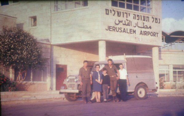
Atarot Airport (Hebrew: נמל התעופה ירושלים, Arabic: مطار القدس الدولي) (IATA: JRS, ICAO: LLJR, OJJR), (also Kalandia Airport, Qalandia Airport, and Jerusalem Airport) is a small airport, currently not in use, located between Jerusalem and Ramallah. When it was opened in 1920 it was the first airport in the British Mandate for Palestine.
Contents
Royal Jordanian and Middle East Airlines were known to operate daily commercial flights to and from Atarot airport before 1967 under the Jordanian occupation. After Israel regained control of the airport in 1967, Arkia and Aeroflot operated daily commercial flights to and from the airport between 1967 and 2001, when the airport was closed to the civilian traffic after the breakout of the Second Intifada in 2001.
History
From 1920 until 1930, the airfield in Kalandia was the only airport in the British Mandate for Palestine. It was used by the British military authorities and prominent guests bound for Jerusalem. In 1931, the Mandatory government expropriated land from the Jewish village of Atarot to expand the airfield, in the process demolishing homes and uprooting fruit orchards. In 1936, the airport was opened for regular flights. The village of Atarot was captured and destroyed by the Jordanian Arab Legion during the 1948 Arab-Israeli War.
From 1948 to the Six Day War in June 1967, the airport was under Jordanian control, designated OJJR. Following the Six Day War, the Jerusalem airport was incorporated into the Jerusalem city municipal area and was designated LLJR.
In the 1970s and early 1980s, Israel invested considerable resources in upgrading the airport and creating the infrastructure for a full-fledged international airport but the international aviation authorities bowed to Arab political pressure and would not allow international flights to land there. Thus the airport was only used for domestic flights and charter flights.
During the Second Intifada in 2000, the airport became a target for stone-throwing and the runways were littered by thousands of stones. In October 2000, the airport was closed to civilian air traffic and by July 2001 it was formally handed over to the Israel Defense Forces.
In maps presented by Israel at the 2000 Camp David Summit, Atarot was included in the Israeli built-up area of Jerusalem. This was rejected by the Palestinian delegation, which envisioned it as a national airport for the Palestinians. Yossi Beilin proposed that the airport be used jointly as part of an overall sharing of Jerusalem between Israel and Palestinian Authority, citing the successful model of Geneva International Airport, which is used by both Switzerland and France.
ICAO codes
The airport is sometimes shown with two different ICAO codes. The LL designator is used by ICAO for airports in Israel and OJ is the code for Jordan.
In popular culture
The airport appeared in the film World War Z as the main Israeli airport defended from a zombie epidemic.