
Population 24 Unitary authority Country England Local time Monday 10:49 PM Ceremonial county Bedfordshire | OS grid reference TL215385 Region East Sovereign state United Kingdom Dialling code 01462 Post town Hitchin | |
 | ||
Weather 3°C, Wind SW at 14 km/h, 92% Humidity | ||
Quickchip 222 astwick forestry
Astwick is a village and civil parish in the Central Bedfordshire district of Bedfordshire, England. At the 2011 Census the population of the village was included in the civil parish of Stotfold.
Contents
- Quickchip 222 astwick forestry
- Map of Astwick Hitchin UK
- Greenfields astwick stotfold bedfordshire
- Geography
- History
- References
Map of Astwick, Hitchin, UK
Greenfields astwick stotfold bedfordshire
Geography
It is located on the River Ivel, just to the north of Stotfold. Hinxworth, in the neighbouring county of Hertfordshire, is also nearby. The Great North Road passes just to the east of the village. The A1 was improved around 1958, began in 1957, known as the Edworth to Astwick Turn scheme. It is the first non-motorway section of dual-carriageway north of the Baldock motorway bypass.
The parish is too small to have a parish council and instead has a parish meeting.
History
Astwick was first recorded in the Domesday Book in 1086. Until the mid-19th century, the parish formed part of the hundred of Biggleswade.
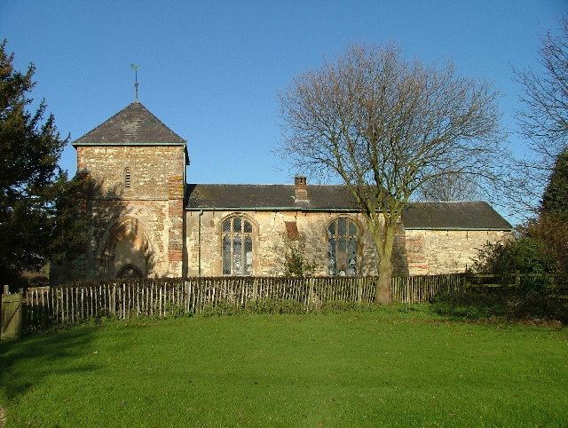
The village has one church, the Parish Church of St Guthlac, one of only two churches in England dedicated to this saint. Another notable building is the moated Astwick Bury, which dates from around 1700 and is Grade II listed.