
 | ||
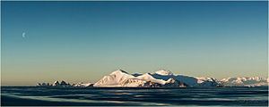
Astrolabe Island, located at 63°17′S 58°40′W, is an island 5 km (3 mi) long, lying in the Bransfield Strait 23 km (14 mi) northwest of Cape Ducorps, Trinity Peninsula in Antarctica. It was discovered by the French expedition, 1837–40, under Captain Jules Dumont d'Urville, and named by him for his chief expedition ship, the Astrolabe. The island was photographed from the air and triangulated by FIDASE, 1956-57.
Contents
Map of Astrolabe Island, Antarctica
Maps
References
Astrolabe Island Wikipedia(Text) CC BY-SA