
Time zone EET (UTC+2) Vehicle registration AI Area code 26460 Team Aiolos Astakou B.C. | Elevation 10 m (30 ft) Postal code 300 06 Local time Monday 8:37 PM Municipality Xiromero Regional unit Aetolia-Acarnania | |
 | ||
Weather 14°C, Wind N at 5 km/h, 79% Humidity | ||
Astakos greece sterea central greece atlasvisual
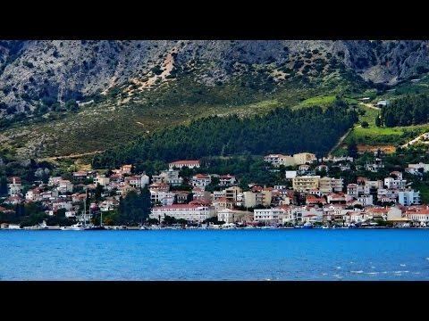
Astakos (Greek: Αστακός, meaning "lobster") is a town and a former municipality in Aetolia-Acarnania, West Greece, Greece. Since the 2011 local government reform it is part of the municipality Xiromero, of which it is a municipal unit. The municipal unit has an area of 345.099 km2. It is located on a bay on the eastern shore of the Ionian Sea, near the southern end of the Acarnanian Mountains. It takes its name from the ancient Acarnanian town Astacus (Ancient Greek: Ἄστακος - Astakos), and was named Dragamesti in the Middle Ages.
Contents
- Astakos greece sterea central greece atlasvisual
- Map of Astakos Greece
- Subdivisions
- Economy
- Persons
- References
Map of Astakos, Greece
It is 16 km southeast of Kalamos (island), 30 km southwest of Agrinio, 35 km northwest of Missolonghi and 55 km southeast of Preveza.
Subdivisions
The municipal unit Astakos is subdivided into the following communities (constituent villages in brackets):
Economy
The city has a port able to hold ferries. The countryside mainly produces wheat, corn and few grapes. Fishing is an important source of income.